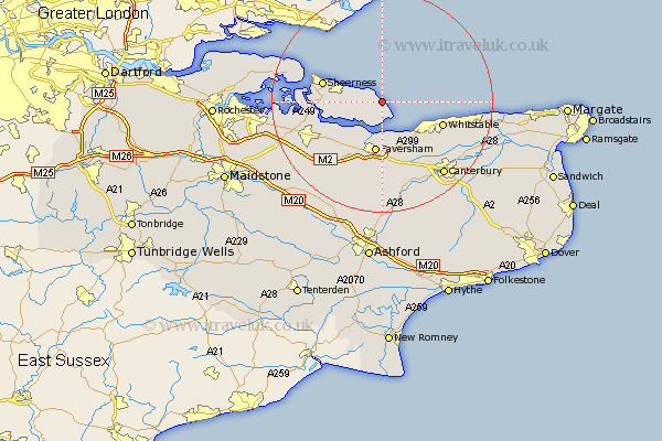
Kent Map Showing Location of Leysdown
Population: 2470
Area Size (ha): 132
District: Swale
Easting: 602857 Northing: 170866
Latitude: 51.4 Longitude: 0.92
 = Leysdown
Area Size (ha): 132
District: Swale
Easting: 602857 Northing: 170866
Latitude: 51.4 Longitude: 0.92
= Leysdown
This Leysdown map below is supplied by Google. Use the tools in the top left corner to zoom into street level or zoom out for a road map, you may also need to zoom in to see Leysdown on the map. Click and drag the map to move around. If the map fails to load try and refresh your browser or zoom in or out (+ or -).
Update - it seems Google no longer allow people to use their maps for free! This Leysdown map sometimes loads and sometimes gives a error. I am working on a solution.
Closest 30 Towns or Cities to Leysdown (Population over 500)
Warden 1.16km Eastchurch 3.47km Minster 7.18km Faversham 9.34km Oare 9.55km Teynham 10.16km Queenborough 10.57km Sheerness 11.04km Whitstable 11.59km Ospringe 11.65km Chestfield 11.8km Iwade 13.25km Sittingbourne 13.74km Dunkirk 13.78km Bapchild 13.94km Blean 14.47km Linsted 14.47km Lynsted 14.47km Selling 14.82km Grain 14.94km Harbledown 15.3km Herne Bay 15.49km Bobbing 16.03km Tunstall 16.69km Broomfield 17.07km Hackington 17.39km Canterbury 17.51km Borden 17.67km Lower Halstow 17.74km Chartham 18.07km