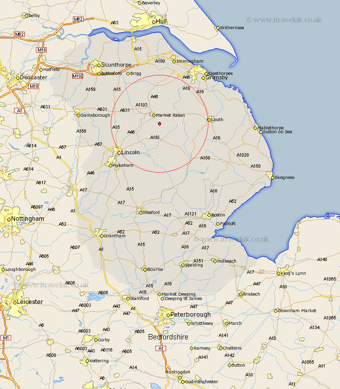
Lincolnshire Map Showing Location of Legsby
Population: 210
District: West Lindsey
Easting: 513147 Northing: 385055
Latitude: 53.35 Longitude: -0.3
 = Legsby
District: West Lindsey
Easting: 513147 Northing: 385055
Latitude: 53.35 Longitude: -0.3
= Legsby
This Legsby map below is supplied by Google. Use the tools in the top left corner to zoom into street level or zoom out for a road map, you may also need to zoom in to see Legsby on the map. Click and drag the map to move around. If the map fails to load try and refresh your browser or zoom in or out (+ or -).
Update - it seems Google no longer allow people to use their maps for free! This Legsby map sometimes loads and sometimes gives a error. I am working on a solution.
Closest 30 Towns or Cities to Legsby (Population over 500)
Market Rasen 4.31km Middle Rasen 5.77km Holton 5.98km Wragby 7.42km binbrook 12.07km Dunholm 12.39km Dunholme 12.39km Scothern 12.42km Welton 13.38km Sudbrooke 13.61km Bardney 14.86km Nettleton 14.86km Caistor 14.86km Nettleham 15.3km Cherry Willingham 15.37km South Kelsey 15.7km Reepham 15.71km Fiskerton 15.71km North Kelsey 16.72km Waddingham 18.16km Washingborough 18.51km Scampton 18.56km Scrampton 18.56km Louth 18.89km Ingham 18.9km Heighington 20.02km Potter Hanworth 20.09km Lincoln 20.22km Banovallum 20.66km Horncastle 20.66km