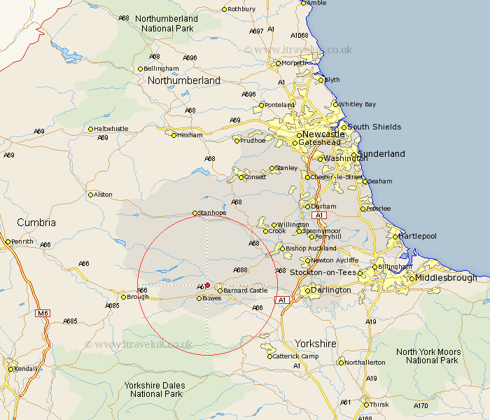
Durham Map Showing Location of Lartington
Population: 133
District: Teesdale
Easting: 402155 Northing: 517208
Latitude: 54.55 Longitude: -1.97
 = Lartington
District: Teesdale
Easting: 402155 Northing: 517208
Latitude: 54.55 Longitude: -1.97
= Lartington
This Lartington map below is supplied by Google. Use the tools in the top left corner to zoom into street level or zoom out for a road map, you may also need to zoom in to see Lartington on the map. Click and drag the map to move around. If the map fails to load try and refresh your browser or zoom in or out (+ or -).
Update - it seems Google no longer allow people to use their maps for free! This Lartington map sometimes loads and sometimes gives a error. I am working on a solution.
Closest 30 Towns or Cities to Lartington (Population over 500)
Cotherstone 2.15km Barnard Castle 3.72km Startforth 3.72km Middleton in Teesdale 10.56km Staindrop 10.91km Cockfield 13.05km Evenwood 14.87km Gainford 15.05km West Auckland 17.66km Etherley 17.84km High Etherley 17.84km Wolsingham 19.3km Bishop Auckland 22.29km Shildon 22.41km Crook 22.45km Stanhope 22.47km Tow Law 22.55km Coundon 24.17km Willington 25.26km Darlington 25.87km Newton Aycliffe 26.82km Spennymoor 28.86km Cornsay 28.95km Hurworth 29.98km Ferryhill 30.65km Esh 31.1km Brandon 31.65km Castleside 32.15km Ushaw Moor 32.98km Lanchester 33.23km