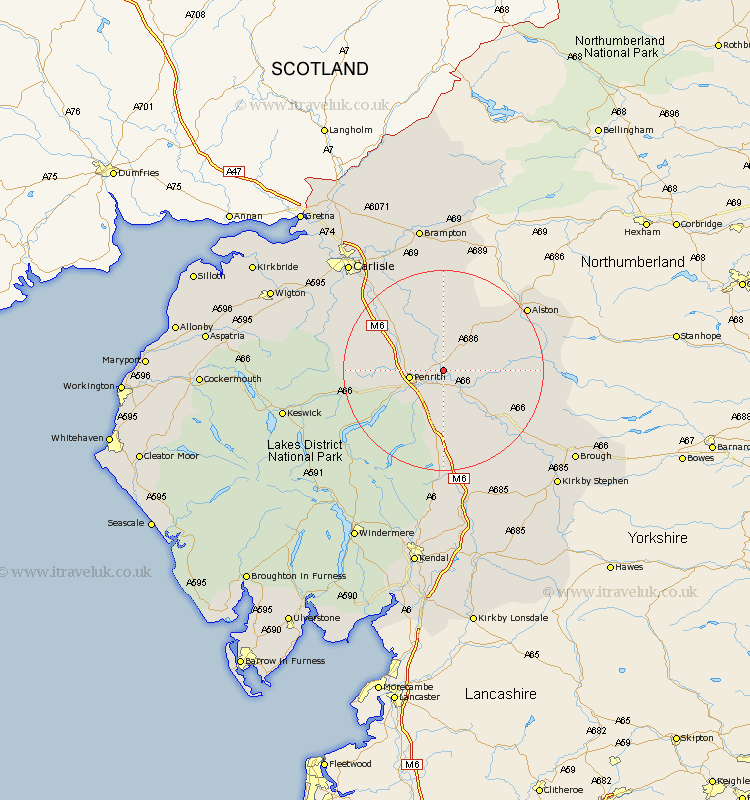
Cumbria Map Showing Location of Langwathby
Population: 748
District: Eden
Easting: 357023 Northing: 532243
Latitude: 54.68 Longitude: -2.67
 = Langwathby
District: Eden
Easting: 357023 Northing: 532243
Latitude: 54.68 Longitude: -2.67
= Langwathby
This Langwathby map below is supplied by Google. Use the tools in the top left corner to zoom into street level or zoom out for a road map, you may also need to zoom in to see Langwathby on the map. Click and drag the map to move around. If the map fails to load try and refresh your browser or zoom in or out (+ or -).
Update - it seems Google no longer allow people to use their maps for free! This Langwathby map sometimes loads and sometimes gives a error. I am working on a solution.
Closest 30 Towns or Cities to Langwathby (Population over 500)
Culgaith 5.67km Lasonby 5.96km Lazonby 5.96km Kirkoswald 9.52km Kirkby Thore 10.54km Skelton 12.99km Dacre 13.03km Long Marston 13.38km Long Marton 13.38km Greystoke 13.38km Ainstable 13.66km Appleby 17.53km Shap 18.53km Crosby Ravensworth 19.29km Wetheral 22.55km Hesket Newmarket 23.16km Hayton 24.68km Orton 24.94km Caldbeck 25.25km Farlam 25.97km Dalston 26.29km Carlisle 28.05km Irthington 28.53km Stanwix 29.54km Thursby 29.72km Brampton 29.96km Brough 30.02km Tebay 30.13km Koswick 30.4km Keswick 30.4km