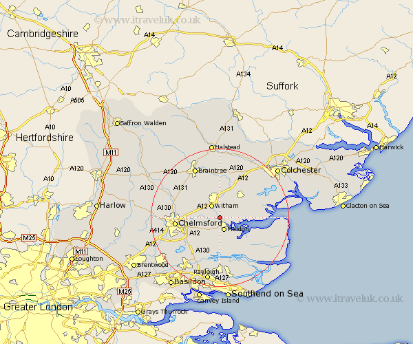
Essex Map Showing Location of Langford
Population: 156
District: Maldon
Easting: 584053 Northing: 209115
Latitude: 51.75 Longitude: 0.67
 = Langford
District: Maldon
Easting: 584053 Northing: 209115
Latitude: 51.75 Longitude: 0.67
= Langford
This Langford map below is supplied by Google. Use the tools in the top left corner to zoom into street level or zoom out for a road map, you may also need to zoom in to see Langford on the map. Click and drag the map to move around. If the map fails to load try and refresh your browser or zoom in or out (+ or -).
Update - it seems Google no longer allow people to use their maps for free! This Langford map sometimes loads and sometimes gives a error. I am working on a solution.
Closest 30 Towns or Cities to Langford (Population over 500)
Heybridge 2.18km Wickham Bishops 3.7km Malden 3.88km Maldon 3.88km Witham 4.36km Hatfield Peverel 5.9km Woodham Mortimer 6.01km Totham 6.01km Great Totham 6.01km Goldhanger 6.03km Tolleshunt Major 6.88km Little Baddow 7.13km Tiptree 7.21km Boreham 8.24km Tolleshunt Knights 8.84km Danbury 8.85km Cold Norton 9.26km Rivenhall 9.26km Purleigh 9.33km Tolleshunt D'Arcy 9.36km Bickacre 9.38km Bicknacre 9.38km Kelvedon 9.55km Terling 9.76km Latchingdon 10.34km Snoreham 10.34km Latchingdon and Snoreham 10.34km Tollesbury 11.47km Feering 11.64km Cressing 12.03km