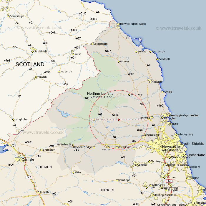
Northumberland Map Showing Location of Kirkwhelpington
Population: 381
District: Tynedale
Easting: 400000 Northing: 583968
Latitude: 55.15 Longitude: -2
 = Kirkwhelpington
District: Tynedale
Easting: 400000 Northing: 583968
Latitude: 55.15 Longitude: -2
= Kirkwhelpington
This Kirkwhelpington map below is supplied by Google. Use the tools in the top left corner to zoom into street level or zoom out for a road map, you may also need to zoom in to see Kirkwhelpington on the map. Click and drag the map to move around. If the map fails to load try and refresh your browser or zoom in or out (+ or -).
Update - it seems Google no longer allow people to use their maps for free! This Kirkwhelpington map sometimes loads and sometimes gives a error. I am working on a solution.
Closest 30 Towns or Cities to Kirkwhelpington (Population over 500)
Otterburn 12.92km Chollerton 14.45km Challerton 14.45km Bellingham 14.83km Stamfordham 15.5km Humshaugh 15.5km Wark 16.61km Longhorsley 17.47km Sandhoe 18.81km Ponteland 19.41km Rothbury 19.59km Acomb 19.6km Morpeth 20.2km Longframlington 20.21km Newbrough 20.36km Warden 20.39km Corbridge 20.41km Hebron 20.45km Hexham 21.35km Stannington 21.91km Ovingham 22.08km Hepscott 22.24km Wylam 22.51km Dinnington 23.01km Pegswood 23.37km Swarland 23.75km Felton 24.12km Riding 24.19km Ridingmill 24.19km Prudhoe 24.2km