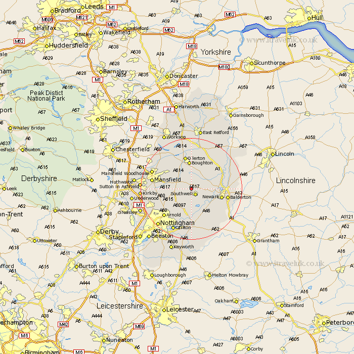
Nottinghamshire Map Showing Location of Kirklington
Population: 363
District: Newark and Sherwood
Easting: 468063 Northing: 356382
Latitude: 53.1 Longitude: -0.98
 = Kirklington
District: Newark and Sherwood
Easting: 468063 Northing: 356382
Latitude: 53.1 Longitude: -0.98
= Kirklington
This Kirklington map below is supplied by Google. Use the tools in the top left corner to zoom into street level or zoom out for a road map, you may also need to zoom in to see Kirklington on the map. Click and drag the map to move around. If the map fails to load try and refresh your browser or zoom in or out (+ or -).
Update - it seems Google no longer allow people to use their maps for free! This Kirklington map sometimes loads and sometimes gives a error. I am working on a solution.
Closest 30 Towns or Cities to Kirklington (Population over 500)
Southwell 2.74km Farnsfield 3.34km Bilsthorpe 4.98km Fiskerton 7.87km Fiskerton Ferry 7.87km Oxton 7.87km Bleasby 8.13km Rainworth 9.09km Claverton 9.98km Calverton 9.98km Blidworth 10.19km Farndon 10.5km Clipstone 10.75km Edwinstowe 10.8km Woodborough 10.81km Boughton 11.14km North Muskham 11.28km Muskham 11.28km Newark-on-Trent 11.73km Newark on Trent 11.73km Newark upon Trent 11.73km Newark 11.73km Elston 12.11km Ollerton 13.16km Winthorpe 13.35km Burton Joyce 13.4km Balderton 13.86km Lambley 14.12km Flintham 14.12km Papplewick 14.47km