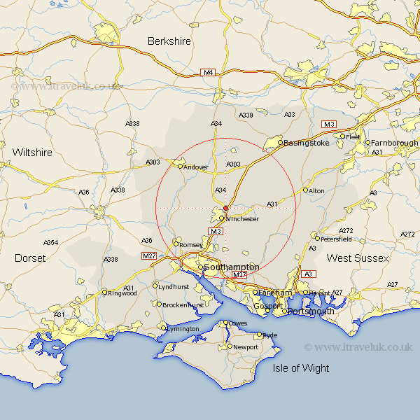
Hampshire Map Showing Location of Kings Worthy
Population: 4459
Area Size (ha): 154
District: Winchester
Easting: 449025 Northing: 131845
Latitude: 51.08 Longitude: -1.3
 = Kings Worthy
Area Size (ha): 154
District: Winchester
Easting: 449025 Northing: 131845
Latitude: 51.08 Longitude: -1.3
= Kings Worthy
This Kings Worthy map below is supplied by Google. Use the tools in the top left corner to zoom into street level or zoom out for a road map, you may also need to zoom in to see Kings Worthy on the map. Click and drag the map to move around. If the map fails to load try and refresh your browser or zoom in or out (+ or -).
Update - it seems Google no longer allow people to use their maps for free! This Kings Worthy map sometimes loads and sometimes gives a error. I am working on a solution.
Closest 30 Towns or Cities to Kings Worthy (Population over 500)
Winchester 3.18km Micheldever 6.03km Sparsholt 6.11km Twyford 7.5km Wonston 7.51km Compton 7.76km New Alresford 9.31km Owslebury 9.55km Otterbourne 9.9km Cheriton 10.03km Hursley 10.18km Barton Stacey 10.38km Chilbolton 11.9km Stockbridge 12.94km Kings Somborne 12.94km Longparish 13.13km Bishopstoke 13.17km Eastleigh 13.43km Upham 13.78km Bramdean 13.97km Whitchurch 15.01km Michelmersh 15.04km Michlemersh 15.04km Durley 15.23km Ropley 15.25km North Waltham 15.32km Goodworth Clatford 15.8km Clatford 15.8km Lower Clatford 15.8km Bishop's Waltham 15.93km