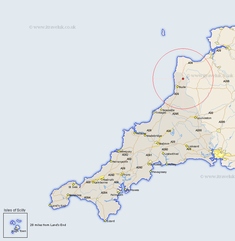
Cornwall Map Showing Location of Kilkhampton
Population: 1193
District: North Cornwall
Easting: 225336 Northing: 112311
Latitude: 50.88 Longitude: -4.48
 = Kilkhampton
District: North Cornwall
Easting: 225336 Northing: 112311
Latitude: 50.88 Longitude: -4.48
= Kilkhampton
This Kilkhampton map below is supplied by Google. Use the tools in the top left corner to zoom into street level or zoom out for a road map, you may also need to zoom in to see Kilkhampton on the map. Click and drag the map to move around. If the map fails to load try and refresh your browser or zoom in or out (+ or -).
Update - it seems Google no longer allow people to use their maps for free! This Kilkhampton map sometimes loads and sometimes gives a error. I am working on a solution.
Closest 30 Towns or Cities to Kilkhampton (Population over 500)
Moorwinstow 5.03km Morwenstow 5.03km Bude 6.58km Markhamchurch 9.55km Marhamchurch 9.55km Pounstock 13.78km Poundstock 13.78km North Petherwin 22.52km Forrabury 27.63km Launceston 28.98km South Petherwin 30.47km Tintagel 30.52km Altarnun 31.7km Lewannick 31.7km Camelford 32.81km Lezant 34.65km North Hill 37.23km Linkinhorne 39.78km Blisland 43.13km Callington 44.54km Cardingham 46km Cardinham 46km Wadebridge 47.64km Liskeard 48.24km Dobwalls 48.24km Bere Alston 48.75km Calstock 48.75km Bodmin 49.16km Padstow 50.19km Menheniot 50.26km