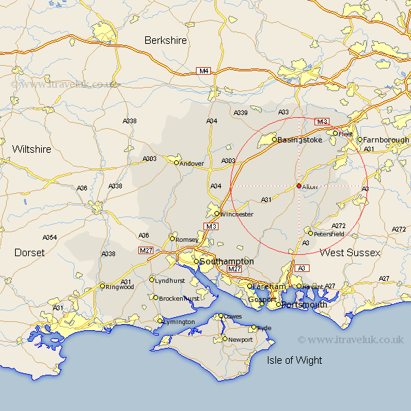
Hampshire Map Showing Location of Alton
Population: 15819
Area Size (ha): 442
District: East Hampshire
Easting: 471126 Northing: 137663
Latitude: 51.13 Longitude: -0.98
 = Alton
Area Size (ha): 442
District: East Hampshire
Easting: 471126 Northing: 137663
Latitude: 51.13 Longitude: -0.98
= Alton
This Alton map below is supplied by Google. Use the tools in the top left corner to zoom into street level or zoom out for a road map, you may also need to zoom in to see Alton on the map. Click and drag the map to move around. If the map fails to load try and refresh your browser or zoom in or out (+ or -).
Update - it seems Google no longer allow people to use their maps for free! This Alton map sometimes loads and sometimes gives a error. I am working on a solution.
Closest 30 Towns or Cities to Alton (Population over 500)
Faringdon 3.7km Farringdon 3.7km Upper Farringdon 3.7km Four Marks 5.01km Froyle 5.95km Medstead 6.1km Selborne 6.56km Binsted 7.22km Kingsley 8.35km Upton Grey 9.35km Bordon 9.49km Bordon Camp 9.49km Bentley 9.86km Long Sutton 9.91km Ropley 10.18km Greatham 10.94km Headley 11.78km Liss 12.55km Froxfield 13.02km Crondall 13.13km Steep 13.43km Odiham 13.44km Dummer 13.79km New Alresford 13.95km Bramshot 13.95km Bramdean 14.5km West Meon 14.73km Liphook 14.79km Hook 15.01km Petersfield 15.23km