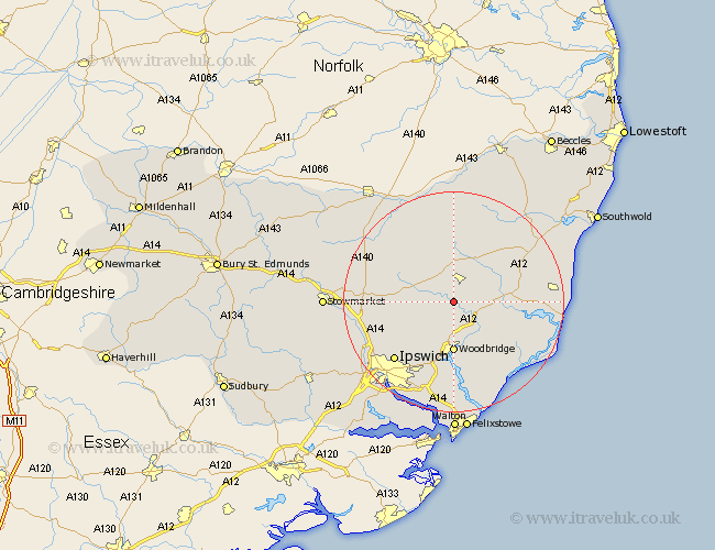
Suffolk Map Showing Location of Kettleburgh
Population: 211
District: Suffolk Coastal
Easting: 626706 Northing: 259125
Latitude: 52.18 Longitude: 1.32
 = Kettleburgh
District: Suffolk Coastal
Easting: 626706 Northing: 259125
Latitude: 52.18 Longitude: 1.32
= Kettleburgh
This Kettleburgh map below is supplied by Google. Use the tools in the top left corner to zoom into street level or zoom out for a road map, you may also need to zoom in to see Kettleburgh on the map. Click and drag the map to move around. If the map fails to load try and refresh your browser or zoom in or out (+ or -).
Update - it seems Google no longer allow people to use their maps for free! This Kettleburgh map sometimes loads and sometimes gives a error. I am working on a solution.
Closest 30 Towns or Cities to Kettleburgh (Population over 500)
Framlingham 3.88km Wickham Market 5.03km Otley 6.78km Ufford 7.75km Melton 9.26km Woodbridge 9.26km Dennington 9.34km Debenham 9.82km Rendlesham 10.07km Grundisburgh 10.32km Worlingworth 10.33km Tunstall 10.66km Martlesham 11.18km Snape 12.5km Wirnesham 12.98km Witnesham 12.98km Saxmundham 13.03km Sutton 13.16km Martlesham Heath 13.16km Laxfield 13.42km Henley 13.57km Coddenham 14.73km Ipswich 15.11km Stradbroke 15.22km Yoxford 16.48km Thorndon 16.72km Hollesley 16.83km Leiston 17.14km Bucklesham 17.29km Cookley 17.39km