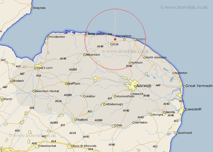
Norfolk Map Showing Location of Kelling
Population: 175
District: North Norfolk
Easting: 609434 Northing: 341904
Latitude: 52.93 Longitude: 1.12
 = Kelling
District: North Norfolk
Easting: 609434 Northing: 341904
Latitude: 52.93 Longitude: 1.12
= Kelling
This Kelling map below is supplied by Google. Use the tools in the top left corner to zoom into street level or zoom out for a road map, you may also need to zoom in to see Kelling on the map. Click and drag the map to move around. If the map fails to load try and refresh your browser or zoom in or out (+ or -).
Update - it seems Google no longer allow people to use their maps for free! This Kelling map sometimes loads and sometimes gives a error. I am working on a solution.
Closest 30 Towns or Cities to Kelling (Population over 500)
Weybourne 2.23km Holt 4.32km Sheringham 5.58km Blakeney 8.65km Runton 8.94km West Runton 8.94km Briston 9.85km Melton Constable 10.82km Mellon Constable 10.82km Cromer 12.29km Corpusty 13.01km Roughton 13.49km Erpingham 14.27km Hindolveston 14.6km Northrepps 14.99km Overstrand 15.75km Little Walsingham 16.61km Walsingham 16.61km Little Snoring 17.24km Foulham 17.98km Foulsham 17.98km Wells-on-Sea 18.25km Wells next the Sea 18.25km Wells on Sea 18.25km Wells 18.25km Wells-next-the-Sea 18.25km Ryburgh 18.66km Great Ryburgh 18.66km Cawston 18.83km Aylsham 18.93km