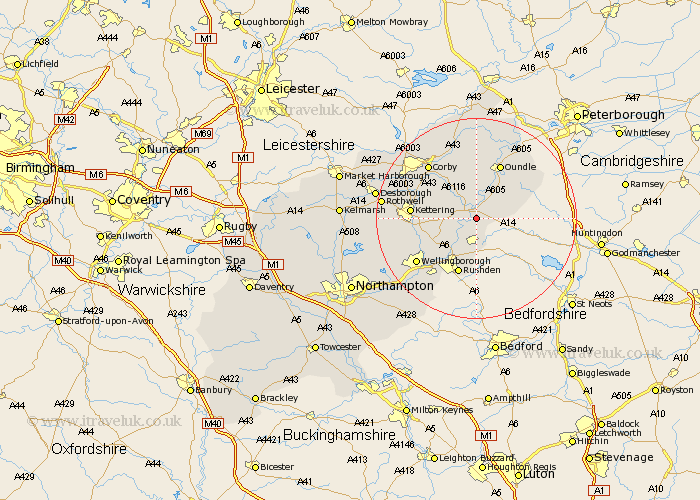
Northamptonshire Map Showing Location of Islip
Population: 763
District: East Northamptonshire
Easting: 499812 Northing: 277195
Latitude: 52.38 Longitude: -0.53
 = Islip
District: East Northamptonshire
Easting: 499812 Northing: 277195
Latitude: 52.38 Longitude: -0.53
= Islip
This Islip map below is supplied by Google. Use the tools in the top left corner to zoom into street level or zoom out for a road map, you may also need to zoom in to see Islip on the map. Click and drag the map to move around. If the map fails to load try and refresh your browser or zoom in or out (+ or -).
Update - it seems Google no longer allow people to use their maps for free! This Islip map sometimes loads and sometimes gives a error. I am working on a solution.
Closest 30 Towns or Cities to Islip (Population over 500)
Thrapston 1.86km Woodford 2.92km Titchmarsh 3.87km Ringstead 3.87km Raunds 5.56km Stanwick 7.49km Irthlingborough 8.68km Brigstock 8.69km Finedon 8.78km Burton Latimer 9.78km Higham Ferrers 9.87km Geddington 11.59km Rushden 11.63km Isham 11.91km Oundle 12km Stanion 12.19km Kettering 12.58km Weldon 13.02km Corby 14.33km Wellingborough 14.63km Irchester 14.64km Warmington 15.81km Broughton 15.95km Doddington 17.22km Great Doddington 17.22km Wollaston 17.37km Wilby 17.98km Cottingham 18.42km Rowell 18.47km Rothwell 18.47km