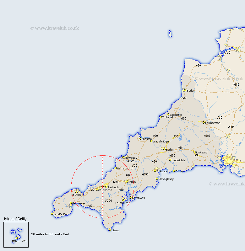
Cornwall Map Showing Location of Illogan
Population: 5585
District: Kerrier
Easting: 167067 Northing: 42209
Latitude: 50.23 Longitude: -5.27
 = Illogan
District: Kerrier
Easting: 167067 Northing: 42209
Latitude: 50.23 Longitude: -5.27
= Illogan
This Illogan map below is supplied by Google. Use the tools in the top left corner to zoom into street level or zoom out for a road map, you may also need to zoom in to see Illogan on the map. Click and drag the map to move around. If the map fails to load try and refresh your browser or zoom in or out (+ or -).
Update - it seems Google no longer allow people to use their maps for free! This Illogan map sometimes loads and sometimes gives a error. I am working on a solution.
Closest 30 Towns or Cities to Illogan (Population over 500)
Redruth 2.37km Camborne 4.01km Portreath 4.41km Troon 4.43km St Day 5.93km St. Day 5.93km Saint Day 5.93km Chacewater 7.35km Gwennap 7.35km Stithians 8.13km Gwinear 9.03km Crowan 9.56km St. Agnes 9.93km Saint Agnes 9.93km St Agnes 9.93km Hayle 9.99km Heyl 9.99km Wendron 11.18km Perranzabuloe 13.87km Penryn 13.98km Budock Water 14.14km Budock 14.14km Kenwyn 14.7km Constantine 14.79km Constatine 14.79km Helstone 14.87km Helston 14.87km Gweek 15.24km Perranporth 15.4km Germol 15.4km