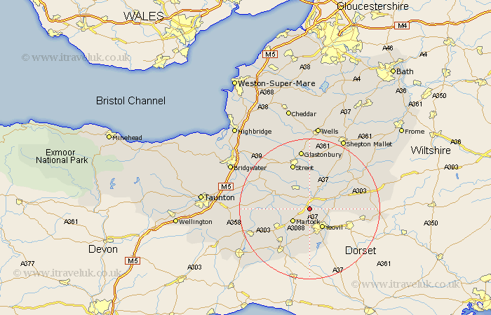
Somerset Map Showing Location of Ilchester
Population: 1661
Area Size (ha): 44
District: South Somerset
Easting: 352055 Northing: 122572
Latitude: 51 Longitude: -2.68
 = Ilchester
Area Size (ha): 44
District: South Somerset
Easting: 352055 Northing: 122572
Latitude: 51 Longitude: -2.68
= Ilchester
This Ilchester map below is supplied by Google. Use the tools in the top left corner to zoom into street level or zoom out for a road map, you may also need to zoom in to see Ilchester on the map. Click and drag the map to move around. If the map fails to load try and refresh your browser or zoom in or out (+ or -).
Update - it seems Google no longer allow people to use their maps for free! This Ilchester map sometimes loads and sometimes gives a error. I am working on a solution.
Closest 30 Towns or Cities to Ilchester (Population over 500)
Yeovilton 1.17km Tintinhull 4.38km Mudford 5.02km Martock 5.96km Montacute 6.03km Long Sutton 6.12km Yeovil 6.57km Queen Camel 7.24km Somerton 7.26km Charlton Mackrell 7.51km Kingsbury Episcopi 8.37km Kingsbury 8.37km Sparkford 8.96km West Coker 9.26km South Petherton 9.88km West Chinnock 10.37km Butleigh 11.12km Langport 11.13km Barton St David 11.36km Barton Saint David 11.36km Barton St. David 11.36km Compton 11.36km High Ham 11.91km Haselbury Plucknett 12.06km North Cadbury 12.23km Baltonsborough 13.18km Street 13.79km Curry Rivel 14.12km Walton 14.22km Castle Cary 14.89km