Norfolk Map Showing Location of Coltishall
Population: 1926
Area Size (ha): 88
District: Broadland
Easting: 627271 Northing: 320431
Latitude: 52.73 Longitude: 1.37
 = Coltishall
Area Size (ha): 88
District: Broadland
Easting: 627271 Northing: 320431
Latitude: 52.73 Longitude: 1.37
= Coltishall
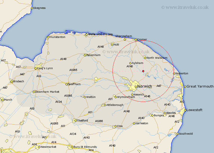
This Coltishall map below is supplied by Google. Use the tools in the top left corner to zoom into street level or zoom out for a road map, you may also need to zoom in to see Coltishall on the map. Click and drag the map to move around. If the map fails to load try and refresh your browser or zoom in or out (+ or -).
Update - it seems Google no longer allow people to use their maps for free! This Coltishall map sometimes loads and sometimes gives a error. I am working on a solution.
Closest 30 Towns or Cities to Coltishall (Population over 500)
Horstead 2.16km Lammas 2.91km Little Hautbois 2.91km Lamas Little Hautbois 2.91km Wroxham 4.33km Hoveton 4.38km Haynford 4.86km Hainford 4.86km Rackheath 5.56km Beeston Saint Lawrence 5.61km Beeston 5.61km Beeston St. Lawrence 5.61km Beeston St Lawrence 5.61km Salhouse 6.5km Smallburgh 6.72km Neatishead 6.73km Hevingham 6.98km Worstead 7.14km Spixworth 7.74km Felmingham 7.75km Horsham St. Faith 7.9km Horsham 7.9km Horsham Saint Faith 7.9km Horsham St Faith 7.9km Marsham 8.68km North Walsham 9.34km Great Plumstead 9.53km Aylsham 9.62km Horsford 9.63km Horning 9.72km