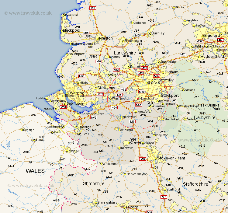
Cheshire Map Showing Location of Altrincham
Population: 39128
Area Size (ha): 982
District: Trafford
Easting: 376722 Northing: 387470
Latitude: 53.38 Longitude: -2.35
 = Altrincham
Area Size (ha): 982
District: Trafford
Easting: 376722 Northing: 387470
Latitude: 53.38 Longitude: -2.35
= Altrincham
This Altrincham map below is supplied by Google. Use the tools in the top left corner to zoom into street level or zoom out for a road map, you may also need to zoom in to see Altrincham on the map. Click and drag the map to move around. If the map fails to load try and refresh your browser or zoom in or out (+ or -).
Update - it seems Google no longer allow people to use their maps for free! This Altrincham map sometimes loads and sometimes gives a error. I am working on a solution.
Closest 30 Towns or Cities to Altrincham (Population over 500)
Bowdon 2.15km Sale 4.98km Partington 5.77km Lymm 5.83km Mere 7.11km High Legh 7.6km Mobberley 7.73km Cheadle 9.03km Knutsford 9.33km Glazebrook 9.52km Wilmslow 9.53km Stockton Heath 10.71km Thelwall 11.05km Risley 11.66km Alderley Edge 12.07km Bramhall 12.3km Culcheth 13.3km Stockport 13.39km Nether Alderley 13.55km Alderley 13.55km Plumley Station 13.7km Plumbley 13.7km Appleton 13.78km Chelford 14.1km Croft 14.38km Peover 14.82km Peover Superior 14.82km Lostock Gralam 15.1km Stretton 15.42km Hazel Grove 15.47km