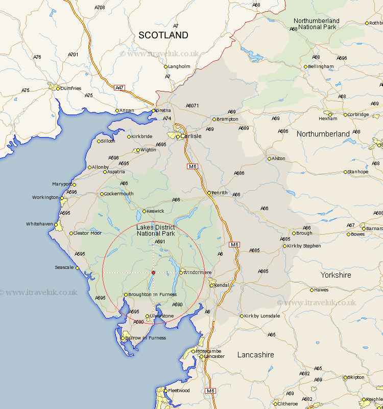
Cumbria Map Showing Location of Coniston
Population: 1058
District: South Lakeland
Easting: 330704 Northing: 497338
Latitude: 54.37 Longitude: -3.07
 = Coniston
District: South Lakeland
Easting: 330704 Northing: 497338
Latitude: 54.37 Longitude: -3.07
= Coniston
This Coniston map below is supplied by Google. Use the tools in the top left corner to zoom into street level or zoom out for a road map, you may also need to zoom in to see Coniston on the map. Click and drag the map to move around. If the map fails to load try and refresh your browser or zoom in or out (+ or -).
Update - it seems Google no longer allow people to use their maps for free! This Coniston map sometimes loads and sometimes gives a error. I am working on a solution.
Closest 30 Towns or Cities to Coniston (Population over 500)
Hawkshead 4.32km Ambleside 8.53km Windermere 9.72km Colton 11.17km Haverthwaite 15.18km Staveley 16.19km Ulverston 18.66km Ulverstone 18.66km Pennington 20.85km Kendal 21.27km Kendall 21.27km Lower Holker 21.4km Holker 21.4km Bootle 22.41km Levens 22.5km Askam 22.6km Askam in Furness 22.6km Millom 22.63km Lindal 22.89km Lindal in Furness 22.89km Natland 23.52km Gosforth 24.03km Great Urswick 24.31km Heversham 24.47km Dalton 24.96km Dalton in Furness 24.96km Arnside 25.4km Milnthorpe 25.64km Koswick 26.14km Keswick 26.14km