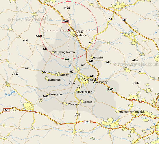
Oxfordshire Map Showing Location of Horley
Population: 319
District: Cherwell
Easting: 442251 Northing: 242997
Latitude: 52.08 Longitude: -1.38
 = Horley
District: Cherwell
Easting: 442251 Northing: 242997
Latitude: 52.08 Longitude: -1.38
= Horley
This Horley map below is supplied by Google. Use the tools in the top left corner to zoom into street level or zoom out for a road map, you may also need to zoom in to see Horley on the map. Click and drag the map to move around. If the map fails to load try and refresh your browser or zoom in or out (+ or -).
Update - it seems Google no longer allow people to use their maps for free! This Horley map sometimes loads and sometimes gives a error. I am working on a solution.
Closest 30 Towns or Cities to Horley (Population over 500)
Wroxton 2.17km Cropredy 4.92km Banbury 5.04km Wardington 7.08km Bloxham 9.33km Adderbury 10.32km Barford St. John 11.18km Barford Saint John 11.18km Barford St John 11.18km Barford 11.18km Deddington 12.02km Hook Norton 13.06km Duns Tew 17.03km Fritwell 18.03km Upper Heyford 18.49km Enstone 19.08km Chipping Norton 19.26km Steeple Aston 19.38km Barton 19.45km Ardley 20.21km Caversfield 22.32km Fringford 23.51km Chadlington 24.04km Tackley 24.51km Churchill 24.56km Charlbury 24.75km Kirtlington 25.38km Bicester 25.9km Kingham 25.9km Chesterton 26.12km