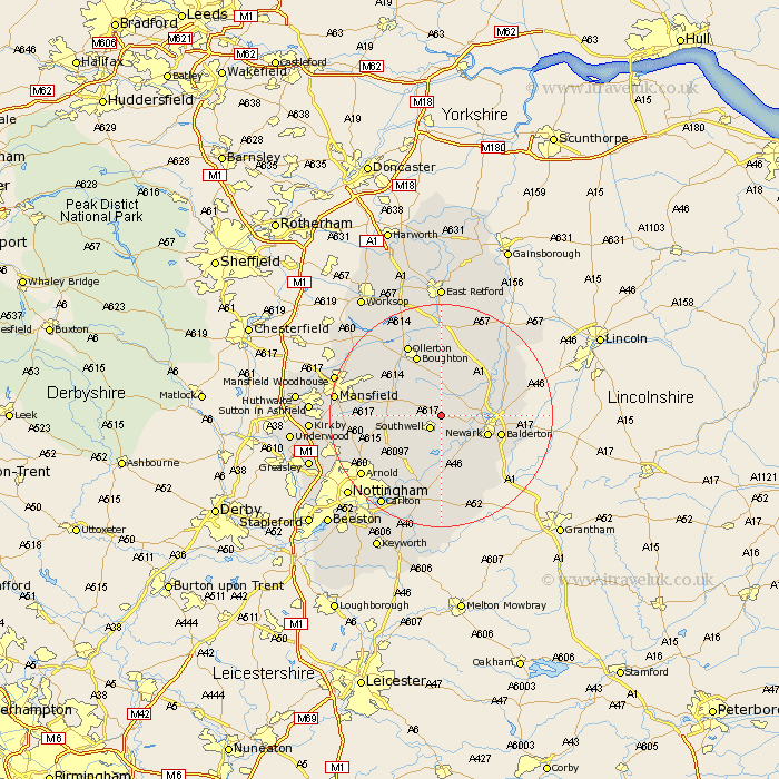
Nottinghamshire Map Showing Location of Hockerton
Population: 142
District: Newark and Sherwood
Easting: 471410 Northing: 356431
Latitude: 53.1 Longitude: -0.93
 = Hockerton
District: Newark and Sherwood
Easting: 471410 Northing: 356431
Latitude: 53.1 Longitude: -0.93
= Hockerton
This Hockerton map below is supplied by Google. Use the tools in the top left corner to zoom into street level or zoom out for a road map, you may also need to zoom in to see Hockerton on the map. Click and drag the map to move around. If the map fails to load try and refresh your browser or zoom in or out (+ or -).
Update - it seems Google no longer allow people to use their maps for free! This Hockerton map sometimes loads and sometimes gives a error. I am working on a solution.
Closest 30 Towns or Cities to Hockerton (Population over 500)
Southwell 2.88km Fiskerton Ferry 5.99km Fiskerton 5.99km Farnsfield 6.68km Bleasby 7.42km Bilsthorpe 7.63km Farndon 7.87km Muskham 8.01km North Muskham 8.01km Newark-on-Trent 8.63km Newark on Trent 8.63km Newark upon Trent 8.63km Newark 8.63km Winthorpe 10.01km Elston 10.28km Oxton 10.5km Balderton 10.68km Boughton 11.82km Rainworth 12.38km Coddington 12.38km Calverton 12.47km Claverton 12.47km Edwinstowe 12.84km Woodborough 12.85km Flintham 13.17km Clipstone 13.37km Tuxford 13.4km Collingham 13.44km North Collingham 13.44km Blidworth 13.48km