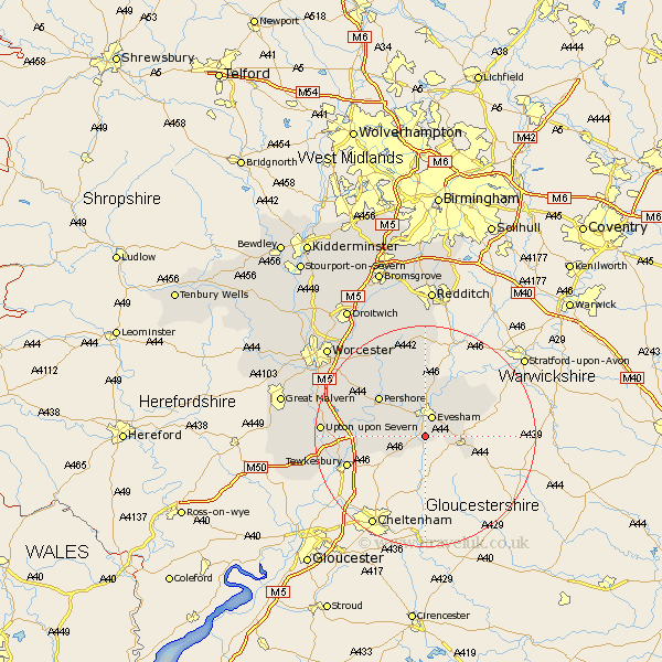
Worcestershire Map Showing Location of Hinton On The Green
Population: 254
District: Wychavon
Easting: 403428 Northing: 239115
Latitude: 52.05 Longitude: -1.95
 = Hinton On The Green
District: Wychavon
Easting: 403428 Northing: 239115
Latitude: 52.05 Longitude: -1.95
= Hinton On The Green
This Hinton On The Green map below is supplied by Google. Use the tools in the top left corner to zoom into street level or zoom out for a road map, you may also need to zoom in to see Hinton On The Green on the map. Click and drag the map to move around. If the map fails to load try and refresh your browser or zoom in or out (+ or -).
Update - it seems Google no longer allow people to use their maps for free! This Hinton On The Green map sometimes loads and sometimes gives a error. I am working on a solution.
Closest 30 Towns or Cities to Hinton On The Green (Population over 500)
Sedgeberrow 2.18km Evesham 3.87km Ashton under Hill 3.89km Ashton-under-Hill 3.89km Cropthorne 5.04km Badsey 5.87km Offenham 6.01km Charlton 6.01km Beckford 6.8km Broadway 7.09km South Littleton 7.19km Littleton 7.19km Fladbury 8.7km Honeybourne 8.79km Cow Honeybourne 8.79km Harvington 9.54km Cleeve Prior 10.87km Pershore 10.89km Church Lench 11.12km Eckington 11.55km Bredon 11.55km Defford 11.98km Pebworth 12.65km Bishampton 13.75km Peopleton 15.12km Wadborough 15.55km Ripple 16.07km Inkberrow 16.72km Upton upon Severn 18.33km Upton on Severn 18.33km