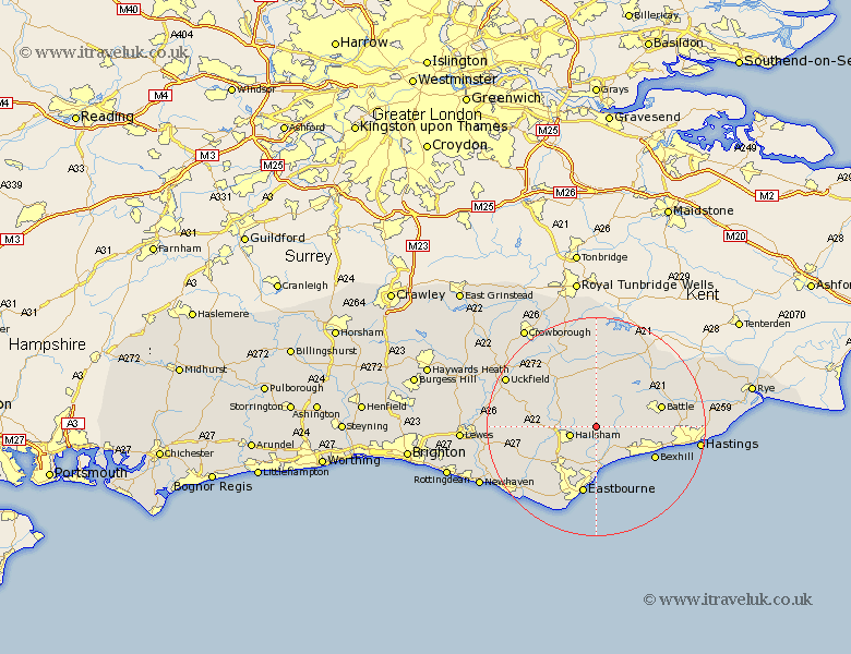
Sussex Map Showing Location of Herstmonceux
Population: 2320
District: Wealden
Easting: 564114 Northing: 111967
Latitude: 50.88 Longitude: 0.33
 = Herstmonceux
District: Wealden
Easting: 564114 Northing: 111967
Latitude: 50.88 Longitude: 0.33
= Herstmonceux
This Herstmonceux map below is supplied by Google. Use the tools in the top left corner to zoom into street level or zoom out for a road map, you may also need to zoom in to see Herstmonceux on the map. Click and drag the map to move around. If the map fails to load try and refresh your browser or zoom in or out (+ or -).
Update - it seems Google no longer allow people to use their maps for free! This Herstmonceux map sometimes loads and sometimes gives a error. I am working on a solution.
Closest 30 Towns or Cities to Herstmonceux (Population over 500)
Hailsham 5.03km Hellingly 6.13km Ninfield 6.13km Warbleton 6.57km Horeham 6.92km Horam 6.92km Catsfield 8.18km Heathfield 8.77km Pevensey 9.34km Pevensey Bay 9.55km Chiddingly 10.68km Mountfield 10.88km Polegate 11.62km Crowhurst 11.84km Bexhill 12.19km East Hoathly 12.26km Battle 12.26km Eastbourne 12.81km Chalvington 13.39km Burwash 13.44km Jevington 13.81km Laughton 14.03km Mayfield 14.23km Sedlescombe 14.51km Robertsbridge 14.52km Etchingham 14.75km Hadlow Down 15.3km Alfriston 15.86km Framfield 15.86km Hurst Green 15.99km