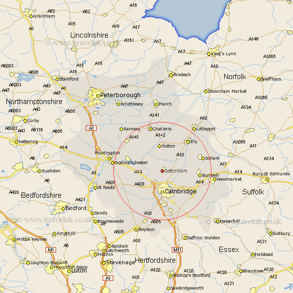
Cambridgeshire Map Showing Location of Cottenham
Population: 4393
Area Size (ha): 134
District: South Cambridgeshire
Easting: 544369 Northing: 267174
Latitude: 52.28 Longitude: 0.12
 = Cottenham
Area Size (ha): 134
District: South Cambridgeshire
Easting: 544369 Northing: 267174
Latitude: 52.28 Longitude: 0.12
= Cottenham
This Cottenham map below is supplied by Google. Use the tools in the top left corner to zoom into street level or zoom out for a road map, you may also need to zoom in to see Cottenham on the map. Click and drag the map to move around. If the map fails to load try and refresh your browser or zoom in or out (+ or -).
Update - it seems Google no longer allow people to use their maps for free! This Cottenham map sometimes loads and sometimes gives a error. I am working on a solution.
Closest 30 Towns or Cities to Cottenham (Population over 500)
Oakington 3.87km Histon 3.88km Long Stanton 4.54km Willingham 5.03km Waterbeach 5.86km Milton 6.01km Girton 6.01km Over 7.75km Haddenham 7.75km Dry Drayton 7.94km Swavesey 8.15km Wilburton 8.15km Cambridge 9.27km Needingworth 9.8km Coton 9.87km Earith 10.06km Bluntisham 10.06km Teversham 10.32km Sutton 11.17km Stretham 11.49km Colne 11.49km Hardwicke 11.5km Hardwick 11.5km Witchford 12.48km Comberton 12.49km Wicken 12.6km Fen Stanton 12.61km St. Ives 12.61km St Ives 12.61km Saint Ives 12.61km