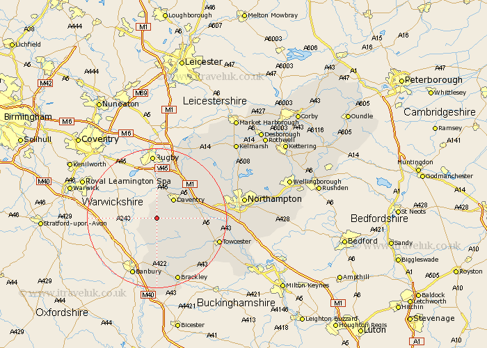
Northamptonshire Map Showing Location of Hellidon
Population: 180
District: Daventry
Easting: 452392 Northing: 256073
Latitude: 52.2 Longitude: -1.23
 = Hellidon
District: Daventry
Easting: 452392 Northing: 256073
Latitude: 52.2 Longitude: -1.23
= Hellidon
This Hellidon map below is supplied by Google. Use the tools in the top left corner to zoom into street level or zoom out for a road map, you may also need to zoom in to see Hellidon on the map. Click and drag the map to move around. If the map fails to load try and refresh your browser or zoom in or out (+ or -).
Update - it seems Google no longer allow people to use their maps for free! This Hellidon map sometimes loads and sometimes gives a error. I am working on a solution.
Closest 30 Towns or Cities to Hellidon (Population over 500)
Byfield 3.7km Badby 3.88km Upper Boddington 5.03km Boddington 5.03km Daventry 7.18km Braunston 9.54km Chipping Warden 9.54km Welton 10.86km Weedon 11.51km Weedon Beck 11.51km Flore 13.03km Barby 13.17km Chalcombe 13.42km Chacombe 13.42km Helmdon 14.66km Bugbrooke 14.77km Greatworth 15.21km Pattishall 15.23km Kilsby 15.5km Long Buckby 15.89km Crick 16.31km Harpole 17.43km Syresham 18.01km Kislingbury 18.26km East Haddon 18.47km Gayton 18.55km Towcester 18.59km West Haddon 18.66km Brackley 19.39km Silverstone 19.67km