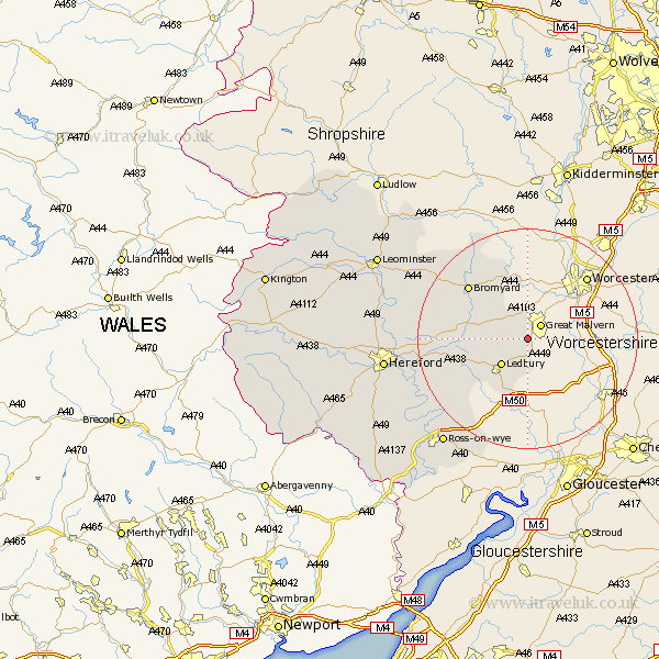
Herefordshire Map Showing Location of Cradley
Population: 1653
Easting: 376000 Northing: 244000
Latitude: 52.09 Longitude: -2.35
 = Cradley
Easting: 376000 Northing: 244000
Latitude: 52.09 Longitude: -2.35
= Cradley
This Cradley map below is supplied by Google. Use the tools in the top left corner to zoom into street level or zoom out for a road map, you may also need to zoom in to see Cradley on the map. Click and drag the map to move around. If the map fails to load try and refresh your browser or zoom in or out (+ or -).
Update - it seems Google no longer allow people to use their maps for free! This Cradley map sometimes loads and sometimes gives a error. I am working on a solution.
Closest 30 Towns or Cities to Cradley (Population over 500)
Colwall 2.52km Ledbury 6.62km Bosbury 6.9km Whitbourne 14.12km Bromyard 14.29km Much Marcle 14.58km Withington 19.34km Upton Bishop 19.59km Mordiford 19.93km Fownhope 19.98km Lugwardine 20.69km Sutton 22.76km Weston-under-Penyard 23.3km Weston under Penyard 23.3km Weston 23.3km Bodenham 23.59km Lea 23.82km Ross on Wye 24.6km Ross-on-wye 24.6km Ross 24.6km Hereford 25.5km Bullingham 25.92km Moreton-on-Lugg 26.17km Moreton on Lugg 26.17km Moreton 26.17km Wellington 27.65km Burghill 28.45km Much Birch 28.75km Walford 28.95km Much Dewchurch 29.95km