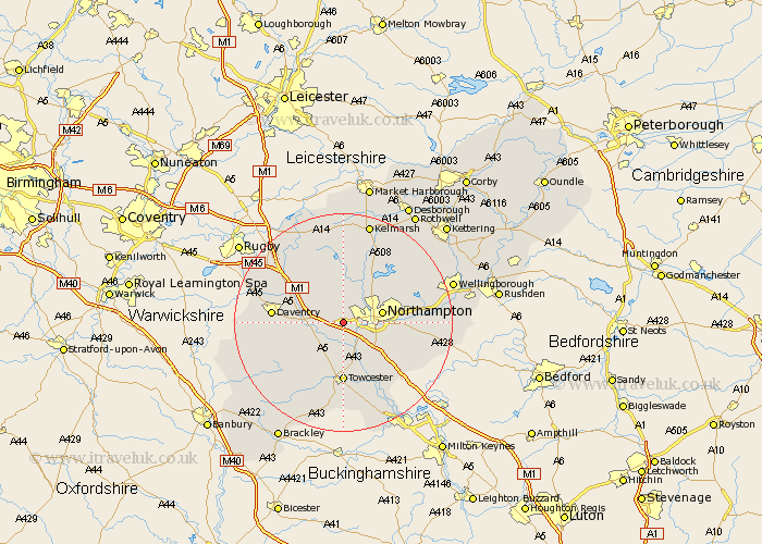
Northamptonshire Map Showing Location of Harpole
Population: 1547
District: South Northamptonshire
Easting: 469423 Northing: 259987
Latitude: 52.23 Longitude: -0.98
 = Harpole
District: South Northamptonshire
Easting: 469423 Northing: 259987
Latitude: 52.23 Longitude: -0.98
= Harpole
This Harpole map below is supplied by Google. Use the tools in the top left corner to zoom into street level or zoom out for a road map, you may also need to zoom in to see Harpole on the map. Click and drag the map to move around. If the map fails to load try and refresh your browser or zoom in or out (+ or -).
Update - it seems Google no longer allow people to use their maps for free! This Harpole map sometimes loads and sometimes gives a error. I am working on a solution.
Closest 30 Towns or Cities to Harpole (Population over 500)
Harpole 0km Kislingbury 2.17km Bugbrooke 4.34km Flore 4.54km Weedon Beck 5.97km Weedon 5.97km Northampton 7.06km Milton 7.18km Gayton 7.49km Pattishall 7.75km Hardingstone 7.75km East Haddon 7.76km Boughton 7.94km Collingtree 7.95km Blisworth 8.15km Wootton 8.79km Long Buckby 9.34km Spratton 9.55km Pitsford 10.07km Houghton 10.38km Great Houghton 10.38km Moulton 10.64km Brixworth 10.87km Towcester 11.12km Guilsborough 11.18km Great Billing 11.5km Billing 11.5km Roade 11.5km West Haddon 12.48km Daventry 12.62km