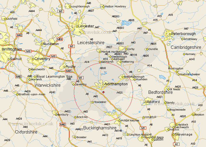
Northamptonshire Map Showing Location of Hardingstone
Population: 3378
Area Size (ha): 119
District: Northampton
Easting: 476309 Northing: 256384
Latitude: 52.2 Longitude: -0.88
 = Hardingstone
Area Size (ha): 119
District: Northampton
Easting: 476309 Northing: 256384
Latitude: 52.2 Longitude: -0.88
= Hardingstone
This Hardingstone map below is supplied by Google. Use the tools in the top left corner to zoom into street level or zoom out for a road map, you may also need to zoom in to see Hardingstone on the map. Click and drag the map to move around. If the map fails to load try and refresh your browser or zoom in or out (+ or -).
Update - it seems Google no longer allow people to use their maps for free! This Hardingstone map sometimes loads and sometimes gives a error. I am working on a solution.
Closest 30 Towns or Cities to Hardingstone (Population over 500)
Wootton 1.86km Collingtree 2.18km Milton 2.93km Houghton 3.88km Great Houghton 3.88km Hackleton 4.91km Blisworth 5.03km Northampton 5.56km Roade 5.56km Kislingbury 5.97km Gayton 6.78km Great Billing 7.18km Billing 7.18km Harpole 7.75km Hartwell 7.76km Denton 7.95km Bugbrooke 9.09km Boughton 9.33km Moulton 9.54km Whiston 9.81km Pattishall 9.82km Towcester 10.08km Yardley Hastings 10.22km Overstone 10.31km Earls Barton 10.65km Pitsford 11.12km Sywell 11.5km Flore 11.94km Weedon 12.63km Weedon Beck 12.63km