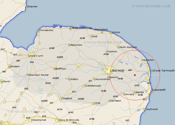
Norfolk Map Showing Location of Halvergate
Population: 468
District: Broadland
Easting: 641502 Northing: 306259
Latitude: 52.6 Longitude: 1.57
 = Halvergate
District: Broadland
Easting: 641502 Northing: 306259
Latitude: 52.6 Longitude: 1.57
= Halvergate
This Halvergate map below is supplied by Google. Use the tools in the top left corner to zoom into street level or zoom out for a road map, you may also need to zoom in to see Halvergate on the map. Click and drag the map to move around. If the map fails to load try and refresh your browser or zoom in or out (+ or -).
Update - it seems Google no longer allow people to use their maps for free! This Halvergate map sometimes loads and sometimes gives a error. I am working on a solution.
Closest 30 Towns or Cities to Halvergate (Population over 500)
Freethorpe 2.17km Acle 3.87km Cantley 5.01km Reedham 5.56km Upton 5.67km Lingwood 5.93km South Walsham 6km Thurlton 7.42km Blofield 8.09km Chedgrave 8.68km Fritton 8.68km Belton 8.71km Filby 8.74km Brundall 9.19km Thurton 10.59km Ludham 11.34km Rollesby 11.46km Loddon 11.47km Martham 11.62km Ormesby St Margaret 11.66km Ormesby Saint Margaret 11.66km Ormesby St. Margaret 11.66km Great Ormesby 11.66km Horning 12km Great Plumstead 12.55km Hemsby 12.91km Great Yarmouth 12.92km Yarmouth 12.92km Potter Heigham 12.97km Hopton on Sea 13.49km