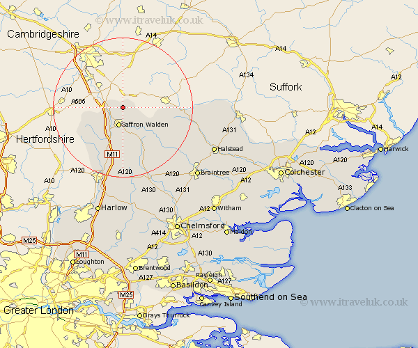
Essex Map Showing Location of Hadstock
Population: 320
District: Uttlesford
Easting: 555351 Northing: 243395
Latitude: 52.07 Longitude: 0.27
 = Hadstock
District: Uttlesford
Easting: 555351 Northing: 243395
Latitude: 52.07 Longitude: 0.27
= Hadstock
This Hadstock map below is supplied by Google. Use the tools in the top left corner to zoom into street level or zoom out for a road map, you may also need to zoom in to see Hadstock on the map. Click and drag the map to move around. If the map fails to load try and refresh your browser or zoom in or out (+ or -).
Update - it seems Google no longer allow people to use their maps for free! This Hadstock map sometimes loads and sometimes gives a error. I am working on a solution.
Closest 30 Towns or Cities to Hadstock (Population over 500)
Ashdon 3.89km Great Chesterford 4.56km Chesterford 4.56km Littlebury 5.05km Saffron Walden 5.68km Wymbyshe 8.17km Winebisc 8.17km Wimbish 8.17km Gwimbach 8.17km Wimbeis 8.17km Winbeche 8.17km Wenbech 8.17km Radwinter 8.71km Newport 9.34km Debden 11.12km Great Sampford 13.01km Steeple Bumpstead 13.08km Quendon 13.75km Clavering 14.38km Thaxted 14.67km Henham 14.88km Finchingfield 16.76km Broxted 16.83km Elsenham 16.83km Manuden 18.03km Ridgwell 18.33km Ridgewell 18.33km Great Easton 19.09km Stansted 19.09km Stansted Mountfitchet 19.09km