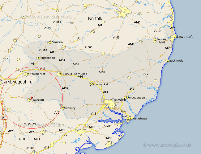
Suffolk Map Showing Location of Great Wratting
Population: 220
District: St. Edmundsbury
Easting: 567790 Northing: 247506
Latitude: 52.1 Longitude: 0.45
 = Great Wratting
District: St. Edmundsbury
Easting: 567790 Northing: 247506
Latitude: 52.1 Longitude: 0.45
= Great Wratting
This Great Wratting map below is supplied by Google. Use the tools in the top left corner to zoom into street level or zoom out for a road map, you may also need to zoom in to see Great Wratting on the map. Click and drag the map to move around. If the map fails to load try and refresh your browser or zoom in or out (+ or -).
Update - it seems Google no longer allow people to use their maps for free! This Great Wratting map sometimes loads and sometimes gives a error. I am working on a solution.
Closest 30 Towns or Cities to Great Wratting (Population over 500)
Haverhill 2.18km Kedington 2.94km Thurlow 2.94km Hundon 6.83km Clare 9.3km Wickhambrook 9.71km Cavendish 12.66km Chedburgh 14.67km Glemsford 14.8km Chevington 15.9km Moulton 16.83km Newmarket 16.83km Gazeley 17.29km Barrow 17.39km Long Melford 18.59km Exning 19.75km Lawshall 20.13km Sudbury 20.74km Risby 22.36km Great Cornard 22.88km Waldingfield 23.08km Great Waldingfield 23.08km Cockfield 23.42km Lavenham 23.91km Bury Saint Edmunds 24.67km Bury St Edmunds 24.67km Bury St. Edmunds 24.67km Fornham All Saints 25.18km Rushbrooke 25.2km Bradfield St. George 26.34km