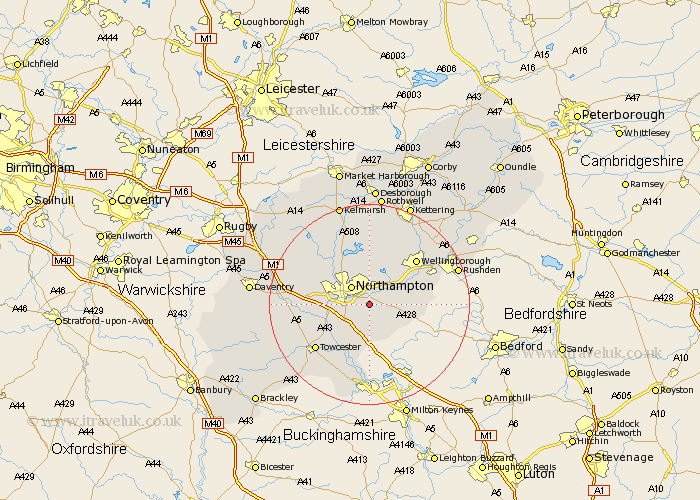
Northamptonshire Map Showing Location of Great Houghton
Population: 636
District: Northampton
Easting: 479695 Northing: 258295
Latitude: 52.22 Longitude: -0.83
 = Great Houghton
District: Northampton
Easting: 479695 Northing: 258295
Latitude: 52.22 Longitude: -0.83
= Great Houghton
This Great Houghton map below is supplied by Google. Use the tools in the top left corner to zoom into street level or zoom out for a road map, you may also need to zoom in to see Great Houghton on the map. Click and drag the map to move around. If the map fails to load try and refresh your browser or zoom in or out (+ or -).
Update - it seems Google no longer allow people to use their maps for free! This Great Houghton map sometimes loads and sometimes gives a error. I am working on a solution.
Closest 30 Towns or Cities to Great Houghton (Population over 500)
Billing 3.87km Great Billing 3.87km Hardingstone 3.88km Hackleton 3.88km Denton 4.91km Northampton 5.03km Wootton 5.04km Collingtree 5.87km Whiston 5.97km Earls Barton 6.78km Milton 6.79km Yardley Hastings 7.06km Moulton 7.49km Overstone 7.49km Sywell 8.15km Roade 8.16km Boughton 8.68km Blisworth 8.8km Kislingbury 9.08km Hartwell 9.34km Wilby 9.7km Pitsford 9.87km Harpole 10.38km Great Doddington 10.65km Doddington 10.65km Gayton 10.65km Bozeat 11.35km Wollaston 11.94km Brixworth 12.01km Bugbrooke 12.63km