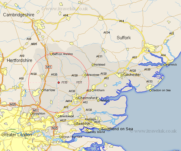
Essex Map Showing Location of Great Canfield
Population: 364
District: Uttlesford
Easting: 559604 Northing: 217552
Latitude: 51.83 Longitude: 0.32
 = Great Canfield
District: Uttlesford
Easting: 559604 Northing: 217552
Latitude: 51.83 Longitude: 0.32
= Great Canfield
This Great Canfield map below is supplied by Google. Use the tools in the top left corner to zoom into street level or zoom out for a road map, you may also need to zoom in to see Great Canfield on the map. Click and drag the map to move around. If the map fails to load try and refresh your browser or zoom in or out (+ or -).
Update - it seems Google no longer allow people to use their maps for free! This Great Canfield map sometimes loads and sometimes gives a error. I am working on a solution.
Closest 30 Towns or Cities to Great Canfield (Population over 500)
High Easter 4.35km Hatfield Broad Oak 4.58km Takeley 5.05km Barnston 6.02km Felsted 6.02km Dunmow 6.53km Great Dunmow 6.53km Great Easton 7.5km Hatfield Heath 7.81km Stebbing 8.84km Matching 8.84km Hallingbury 9.16km Great Hallingbury 9.16km Broxted 9.34km Roxwell 10.34km Birchanger 10.71km Great Waltham 10.72km Elsenham 10.9km Stansted Mountfitchet 10.92km Stansted Apt 10.92km Stansted 10.92km Sheering 10.95km Fyfield 11.64km Harlow 11.72km Henham 12.02km Little Waltham 12.04km Broomfield 12.7km Thaxted 13.42km Manuden 13.86km Great Leighs 13.87km