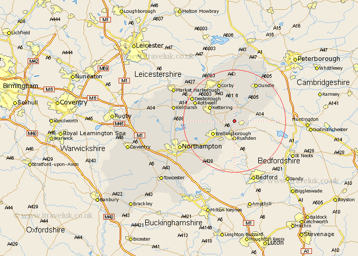
Northamptonshire Map Showing Location of Great Addington
Population: 319
District: East Northamptonshire
Easting: 496482 Northing: 273423
Latitude: 52.35 Longitude: -0.58
 = Great Addington
District: East Northamptonshire
Easting: 496482 Northing: 273423
Latitude: 52.35 Longitude: -0.58
= Great Addington
This Great Addington map below is supplied by Google. Use the tools in the top left corner to zoom into street level or zoom out for a road map, you may also need to zoom in to see Great Addington on the map. Click and drag the map to move around. If the map fails to load try and refresh your browser or zoom in or out (+ or -).
Update - it seems Google no longer allow people to use their maps for free! This Great Addington map sometimes loads and sometimes gives a error. I am working on a solution.
Closest 30 Towns or Cities to Great Addington (Population over 500)
Woodford 2.17km Ringstead 2.26km Finedon 3.87km Raunds 3.87km Irthlingborough 3.87km Stanwick 4.34km Islip 5.02km Higham Ferrers 5.56km Burton Latimer 5.66km Thrapston 6.51km Rushden 7.42km Isham 7.92km Titchmarsh 8.78km Wellingborough 9.68km Irchester 9.87km Kettering 10.62km Brigstock 11.18km Geddington 11.48km Great Doddington 12.19km Doddington 12.19km Wollaston 12.48km Broughton 12.59km Wilby 12.96km Stanion 13.74km Weldon 15.21km Sywell 15.48km Corby 15.86km Bozeat 15.87km Earls Barton 15.88km Walgrave 15.96km