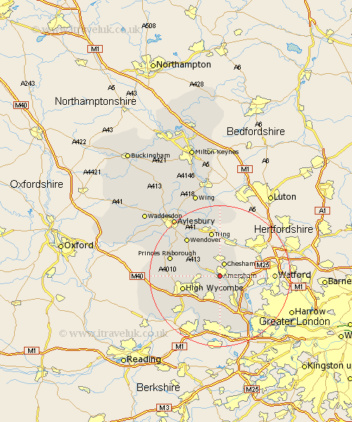
Buckinghamshire Map Showing Location of Amersham
Population: 21024
Area Size (ha): 869
District: Chiltern
Easting: 495658 Northing: 197393
Latitude: 51.67 Longitude: -0.62
 = Amersham
Area Size (ha): 869
District: Chiltern
Easting: 495658 Northing: 197393
Latitude: 51.67 Longitude: -0.62
= Amersham
This Amersham map below is supplied by Google. Use the tools in the top left corner to zoom into street level or zoom out for a road map, you may also need to zoom in to see Amersham on the map. Click and drag the map to move around. If the map fails to load try and refresh your browser or zoom in or out (+ or -).
Update - it seems Google no longer allow people to use their maps for free! This Amersham map sometimes loads and sometimes gives a error. I am working on a solution.
Closest 30 Towns or Cities to Amersham (Population over 500)
Little Missenden 3.45km Chesham 3.88km Latimer 4.95km Hazlemere 6.04km Chalfont Saint Giles 6.54km Chalfont St. Giles 6.54km Chalfont St Giles 6.54km Great Missenden 6.83km Lee 7.21km Penn 7.22km Beaconsfield 7.51km Hughenden 8.26km Gerrards Cross 8.57km Chalfont St. Peter 8.73km Chalfont Saint Peter 8.73km Chalfont St Peter 8.73km Prestwood 8.85km Flackwell Heath 9.39km Wycombe 10.99km Chepping 10.99km High Wycombe 10.99km Hedgerley 11.18km Wooburn 12.03km Little Marlow 12.28km Bourne End 12.52km Bradenham 12.78km West Wycombe 13.18km Denham 13.73km Fulmer 13.77km Wendover 14.42km