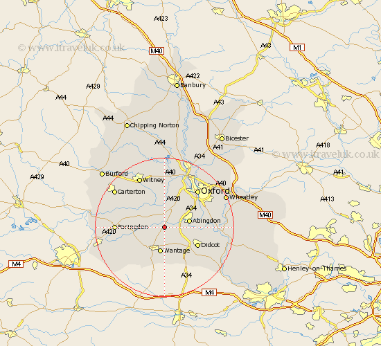
Oxfordshire Map Showing Location of Garford
Population: 142
District: Vale of White Horse
Easting: 442659 Northing: 194810
Latitude: 51.65 Longitude: -1.38
 = Garford
District: Vale of White Horse
Easting: 442659 Northing: 194810
Latitude: 51.65 Longitude: -1.38
= Garford
This Garford map below is supplied by Google. Use the tools in the top left corner to zoom into street level or zoom out for a road map, you may also need to zoom in to see Garford on the map. Click and drag the map to move around. If the map fails to load try and refresh your browser or zoom in or out (+ or -).
Update - it seems Google no longer allow people to use their maps for free! This Garford map sometimes loads and sometimes gives a error. I am working on a solution.
Closest 30 Towns or Cities to Garford (Population over 500)
Kingston Bagpuize 2.96km Kingston Bagpuze 2.96km Marcham 3.45km East Hanney 3.88km Hanney 3.88km Longworth 5.06km Steventon 5.91km Drayton 6.04km Milton 6.84km Abingdon on Thames 7.14km Abingdon-on-Thames 7.14km Abingdon 7.14km Wantage 7.51km Standlake 7.76km Sunningwell 7.83km Wootton 8km Cumnor 8.18km Buckland 8.26km Sutton Courtenay 8.26km Stanford in the Vale 8.26km East Challow 8.73km Harwell 8.86km Stanton Harcourt 9.33km Childrey 10.13km Letcombe Regis 10.34km Long Wittenham 10.52km Didcot 10.75km Radley 10.99km North Hinksey 11.55km Clifton Hampden 12.65km