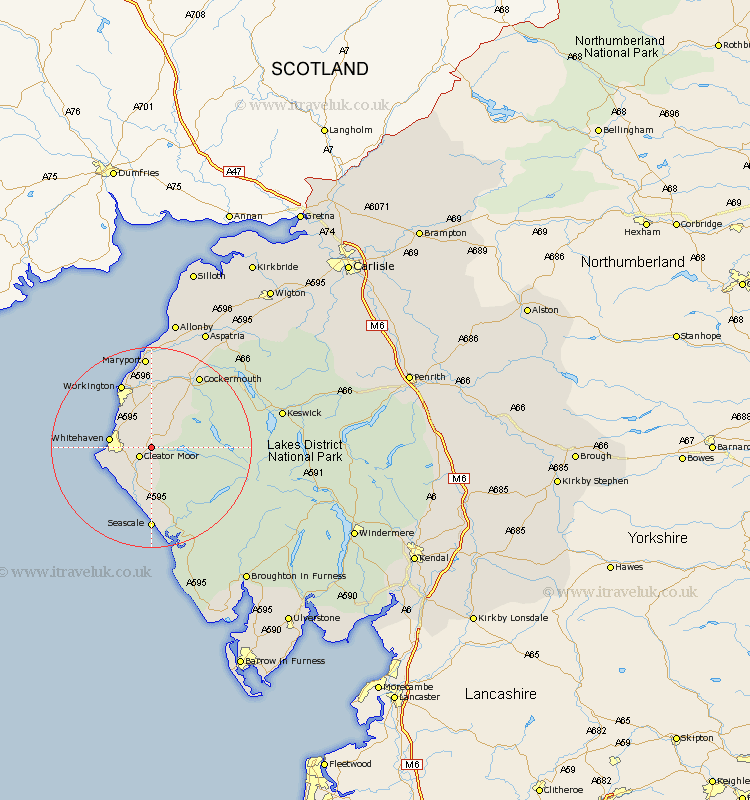
Cumbria Map Showing Location of Frizington
Population: 2415
Area Size (ha): 42
District: Copeland
Easting: 304028 Northing: 516362
Latitude: 54.53 Longitude: -3.48
 = Frizington
Area Size (ha): 42
District: Copeland
Easting: 304028 Northing: 516362
Latitude: 54.53 Longitude: -3.48
= Frizington
This Frizington map below is supplied by Google. Use the tools in the top left corner to zoom into street level or zoom out for a road map, you may also need to zoom in to see Frizington on the map. Click and drag the map to move around. If the map fails to load try and refresh your browser or zoom in or out (+ or -).
Update - it seems Google no longer allow people to use their maps for free! This Frizington map sometimes loads and sometimes gives a error. I am working on a solution.
Closest 30 Towns or Cities to Frizington (Population over 500)
Cleator Moor 2.84km Distington 6.43km Lamplugh 6.53km Parton 7.44km Egremont 7.71km Whitehaven 7.75km Dean 8.09km Lowca 8.51km Saint Bega 9.37km St Bega 9.37km St. Bees 9.37km Saint Bees 9.37km St. Bega 9.37km St Bees 9.37km Brigham 13.67km Workington 14.04km Gosforth 15.17km Seascale 16.68km Broughton Moor 16.71km Flimby 16.82km Cockermouth 17.14km Bridekirk 18.29km Maryport 18.57km Dearham 18.81km Crosscanonby 22.47km Koswick 24.77km Keswick 24.77km Aspatria 25.96km Bootle 30.59km Coniston 32.69km