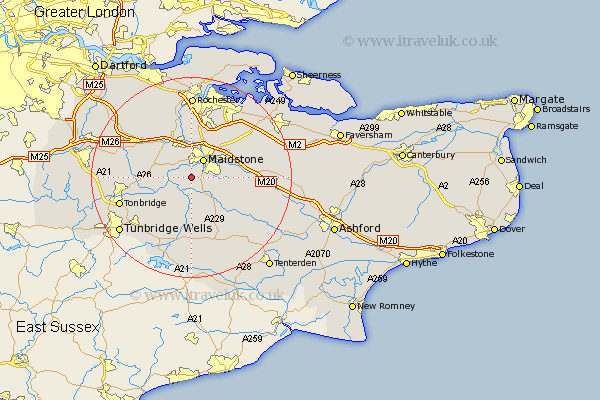
Kent Map Showing Location of East Farleigh
District: Maidstone
Easting: 573350 Northing: 151222
Latitude: 51.23 Longitude: 0.48
 = East Farleigh
Easting: 573350 Northing: 151222
Latitude: 51.23 Longitude: 0.48
= East Farleigh
This East Farleigh map below is supplied by Google. Use the tools in the top left corner to zoom into street level or zoom out for a road map, you may also need to zoom in to see East Farleigh on the map. Click and drag the map to move around. If the map fails to load try and refresh your browser or zoom in or out (+ or -).
Update - it seems Google no longer allow people to use their maps for free! This East Farleigh map sometimes loads and sometimes gives a error. I am working on a solution.
Closest 30 Towns or Cities to East Farleigh (Population over 500)
Barming 2.19km East Barming 2.19km Loose 2.32km Linton 2.97km Hunton 3.7km Yalding 3.94km Boughton Monchelsea 3.94km Maidstone 4.38km Wateringbury 5km East Malling 5.09km Aylesford 5.56km Bearsted 6.89km Langley 6.96km Boxley 7.24km Marden 7.5km East Peckham 7.89km Sutton Valence 7.89km Addington 8.03km West Malling 8.04km Mereworth 8.33km Detling 8.91km Burham 9.27km Leeds 9.28km Offham 9.84km Staplehurst 9.9km Snodland 9.9km Paddock Wood 10.17km Ryarsh 10.17km Hadlow 10.61km Wouldham 11.18km