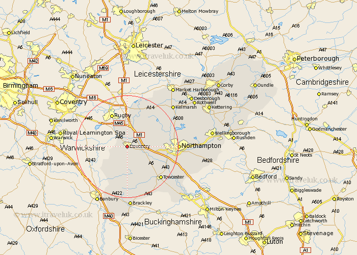
Northamptonshire Map Showing Location of Daventry
Population: 17790
Area Size (ha): 591
District: Daventry
Easting: 456883 Northing: 261684
Latitude: 52.25 Longitude: -1.17
 = Daventry
Area Size (ha): 591
District: Daventry
Easting: 456883 Northing: 261684
Latitude: 52.25 Longitude: -1.17
= Daventry
This Daventry map below is supplied by Google. Use the tools in the top left corner to zoom into street level or zoom out for a road map, you may also need to zoom in to see Daventry on the map. Click and drag the map to move around. If the map fails to load try and refresh your browser or zoom in or out (+ or -).
Update - it seems Google no longer allow people to use their maps for free! This Daventry map sometimes loads and sometimes gives a error. I am working on a solution.
Closest 30 Towns or Cities to Daventry (Population over 500)
Badby 3.87km Welton 3.87km Braunston 4.34km Weedon Beck 7.75km Weedon 7.75km Barby 7.76km Flore 8.16km Long Buckby 8.79km Kilsby 9.26km Crick 9.54km Byfield 10.32km West Haddon 11.49km East Haddon 11.62km Bugbrooke 11.63km Boddington 12.21km Upper Boddington 12.21km Harpole 12.62km Yelvertoft 13.41km Pattishall 13.79km Kislingbury 14.11km Guilsborough 14.64km Chipping Warden 16.31km Gayton 16.48km Spratton 16.5km Towcester 18.02km Blisworth 18.4km Boughton 18.52km Milton 18.58km Helmdon 18.67km Northampton 19.29km