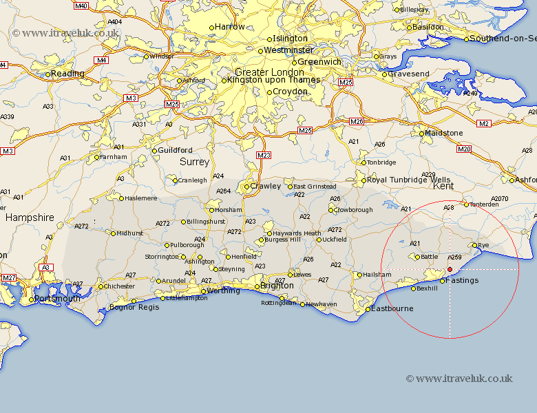
Sussex Map Showing Location of Fairlight
Population: 1525
Area Size (ha): 93
District: Rother
Easting: 585212 Northing: 112677
Latitude: 50.88 Longitude: 0.63
 = Fairlight
Area Size (ha): 93
District: Rother
Easting: 585212 Northing: 112677
Latitude: 50.88 Longitude: 0.63
= Fairlight
This Fairlight map below is supplied by Google. Use the tools in the top left corner to zoom into street level or zoom out for a road map, you may also need to zoom in to see Fairlight on the map. Click and drag the map to move around. If the map fails to load try and refresh your browser or zoom in or out (+ or -).
Update - it seems Google no longer allow people to use their maps for free! This Fairlight map sometimes loads and sometimes gives a error. I am working on a solution.
Closest 30 Towns or Cities to Fairlight (Population over 500)
Pett 2.34km Icklesham 2.99km Hastings 4.38km Brede 4.39km Westfield 5.03km Sedlescombe 7.94km Beckley 9.27km Crowhurst 9.54km Peasmarsh 9.91km Battle 10.06km Rye 10.2km Northiam 11.36km Bexhill 12.19km Catsfield 12.86km Mountfield 12.94km Ninfield 15.31km Robertsbridge 16.13km Hurst Green 17.46km Etchingham 19.1km Pevensey Bay 20.89km Hurstmonceux 21.05km Herstmonceux 21.05km Hurstmonceaux 21.05km Burwash 21.8km Pevensey 21.95km Ticehurst 22.55km Warbleton 25.16km Hailsham 25.79km Eastbourne 26.59km Heathfield 26.75km