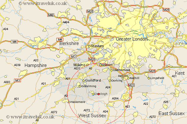
Surrey Map Showing Location of Ewhurst
Population: 2391
District: Waverley
Easting: 509603 Northing: 138339
Latitude: 51.13 Longitude: -0.43
 = Ewhurst
District: Waverley
Easting: 509603 Northing: 138339
Latitude: 51.13 Longitude: -0.43
= Ewhurst
This Ewhurst map below is supplied by Google. Use the tools in the top left corner to zoom into street level or zoom out for a road map, you may also need to zoom in to see Ewhurst on the map. Click and drag the map to move around. If the map fails to load try and refresh your browser or zoom in or out (+ or -).
Update - it seems Google no longer allow people to use their maps for free! This Ewhurst map sometimes loads and sometimes gives a error. I am working on a solution.
Closest 30 Towns or Cities to Ewhurst (Population over 500)
Cranleigh 3.49km Ockley 5.81km Abinger 6.03km Shere 7.77km Alfold 8.05km Capel 8.14km Albury 8.2km Wotton 8.2km Wonersh 8.92km Holmwood 9.85km Bramley 9.85km Dunsfold 10.02km Newdigate 10.63km Saint Martha 10.94km Chilworth 10.94km St Martha 10.94km St. Martha 10.94km Westcott 10.94km Dorking 11.6km Shalford 11.89km Godalming 12.88km Goldaming 12.88km Hambledon 12.93km Horsley 12.98km East Horsley 12.98km Guildford 13.13km Guilford 13.13km Effingham 13.18km Chiddingfold 13.32km West Clandon 13.78km