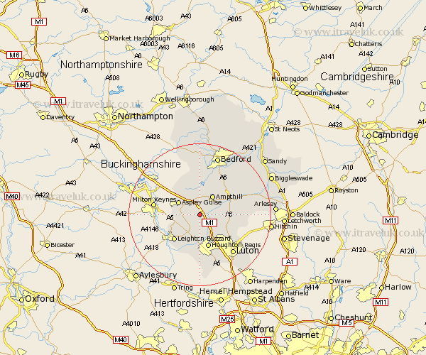
Bedfordshire Map Showing Location of Eversholt
Population: 387
District: Mid Bedfordshire
Easting: 499568 Northing: 232689
Latitude: 51.98 Longitude: -0.55
 = Eversholt
District: Mid Bedfordshire
Easting: 499568 Northing: 232689
Latitude: 51.98 Longitude: -0.55
= Eversholt
This Eversholt map below is supplied by Google. Use the tools in the top left corner to zoom into street level or zoom out for a road map, you may also need to zoom in to see Eversholt on the map. Click and drag the map to move around. If the map fails to load try and refresh your browser or zoom in or out (+ or -).
Update - it seems Google no longer allow people to use their maps for free! This Eversholt map sometimes loads and sometimes gives a error. I am working on a solution.
Closest 30 Towns or Cities to Eversholt (Population over 500)
Woburn 4.57km Westoning 4.93km Flitwick 4.93km Lidlington 5.56km Toddington 5.68km Ampthill 6.53km Aspley Guise 6.81km Pulloxhill 6.85km Flitton 7.09km Marston Moretaine 7.42km Hockliffe 7.75km Maulden 7.79km Heath and Reach 8.83km Silsoe 9.32km Sundon 9.35km Houghton Conquest 9.35km Houghton Regis 9.54km Stanbridge 9.54km Streatley 9.74km Clophill 9.85km Barton 9.86km Barton in the Clay 9.86km Cranfield 9.88km Leighton Buzzard 10.09km Wootton 11.35km Dunstable 11.35km Haynes 11.76km Wilhamstead 12.24km Wilshamstead 12.24km Wilstead 12.24km