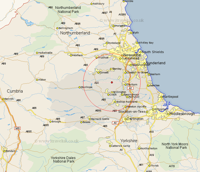
Durham Map Showing Location of Esh
Population: 5023
District: Derwentside
Easting: 419291 Northing: 543207
Latitude: 54.78 Longitude: -1.7
 = Esh
= Esh
District: Derwentside
Easting: 419291 Northing: 543207
Latitude: 54.78 Longitude: -1.7
= Esh
This Esh map below is supplied by Google. Use the tools in the top left corner to zoom into street level or zoom out for a road map, you may also need to zoom in to see Esh on the map. Click and drag the map to move around. If the map fails to load try and refresh your browser or zoom in or out (+ or -).
Update - it seems Google no longer allow people to use their maps for free! This Esh map sometimes loads and sometimes gives a error. I am working on a solution.
Closest 30 Towns or Cities to Esh (Population over 500)
Langley Park 2.83km Ushaw Moor 3.21km Cornsay 4.27km Lanchester 4.28km Witton Gilbert 4.66km Brandon 6.5km Sacriston 6.51km Willington 7.41km Annfield Plain 7.72km Edmondsley 8.56km Durham 8.75km Tow Law 9.32km Crook 9.51km Stanley 10.06km Shincliffe 10.85km Leadgate 11.27km Pelton 11.27km Consetti 11.31km Consett 11.31km Chester-le-Street 11.31km Spennymoor 11.33km Castleside 12.04km Bowburn 13.01km Burnopfield 13.02km Ouston 13.09km Ouston Moor 13.09km West Rainton 13.35km Coundon 13.36km Wolsingham 13.9km Pittington 14.01km