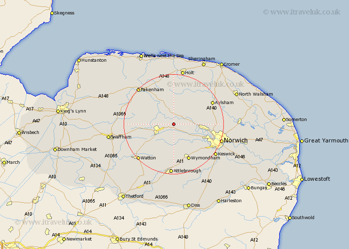
Norfolk Map Showing Location of Elsing
Population: 229
District: Breckland
Easting: 604930 Northing: 315724
Latitude: 52.7 Longitude: 1.03
 = Elsing
District: Breckland
Easting: 604930 Northing: 315724
Latitude: 52.7 Longitude: 1.03
= Elsing
This Elsing map below is supplied by Google. Use the tools in the top left corner to zoom into street level or zoom out for a road map, you may also need to zoom in to see Elsing on the map. Click and drag the map to move around. If the map fails to load try and refresh your browser or zoom in or out (+ or -).
Update - it seems Google no longer allow people to use their maps for free! This Elsing map sometimes loads and sometimes gives a error. I am working on a solution.
Closest 30 Towns or Cities to Elsing (Population over 500)
Lyng 2.91km Bawdeswell 3.7km Hockering 4.33km Mattishall 5.56km North Elmham 6.72km Witchingham 6.72km Dereham 6.99km East Dereham 6.99km Yaxham 7.15km Reepham 7.9km Beetley 8.08km Foulham 9.33km Foulsham 9.33km Taverham 10.77km Cawston 11.65km Mileham 12.89km Drayton 12.9km Shipdham 12.91km Hindolveston 13.02km Hingham 13.41km Costessey 13.55km Corpusty 14.62km Horsford 14.72km Hethersett 15.03km Ryburgh 15.17km Great Ryburgh 15.17km Litcham 15.83km Wymondham 15.85km Marsham 16.37km Hellesdon 16.39km