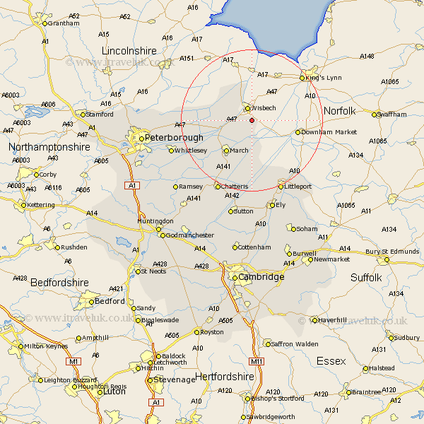
Cambridgeshire Map Showing Location of Elm
Population: 3295
District: Fenland
Easting: 547739 Northing: 306226
Latitude: 52.63 Longitude: 0.18
 = Elm
= Elm
District: Fenland
Easting: 547739 Northing: 306226
Latitude: 52.63 Longitude: 0.18
= Elm
This Elm map below is supplied by Google. Use the tools in the top left corner to zoom into street level or zoom out for a road map, you may also need to zoom in to see Elm on the map. Click and drag the map to move around. If the map fails to load try and refresh your browser or zoom in or out (+ or -).
Update - it seems Google no longer allow people to use their maps for free! This Elm map sometimes loads and sometimes gives a error. I am working on a solution.
Closest 30 Towns or Cities to Elm (Population over 500)
Wisbech 3.88km Newton 8.15km March 11.46km Manea 16.68km Wimblington 16.79km Doddington 18.45km Thorney 19.21km Littleport 21.86km Chatteris 22.29km Downham 22.69km Whittlesey 23.31km Eye 25.03km Mepal 26.33km Ely 26.55km Newborough 27.06km Witchford 27.82km Sutton 28.36km Ramsey 28.76km Stretham 29.73km Petersborough 29.78km Peterbrough 29.78km Peterborough 29.78km Farcet 30.27km Somersham 30.44km Bury 30.78km Warboys 30.97km Glinton 31.49km Wilburton 31.52km Northborough 31.54km Haddenham 31.58km