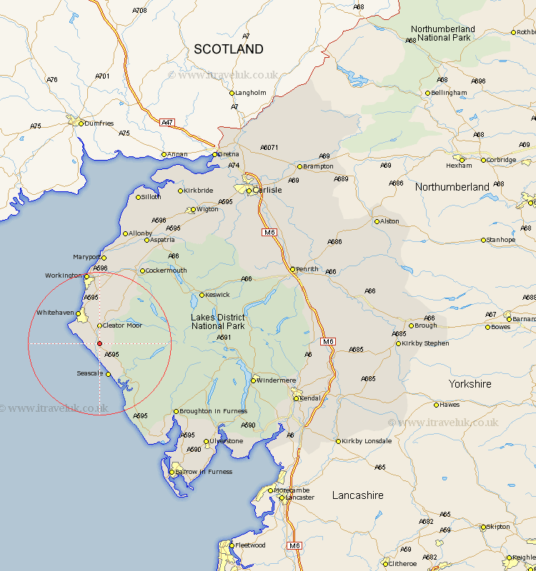
Cumbria Map Showing Location of Egremont
Population: 6496
Area Size (ha): 131
District: Copeland
Easting: 301711 Northing: 508999
Latitude: 54.47 Longitude: -3.52
 = Egremont
Area Size (ha): 131
District: Copeland
Easting: 301711 Northing: 508999
Latitude: 54.47 Longitude: -3.52
= Egremont
This Egremont map below is supplied by Google. Use the tools in the top left corner to zoom into street level or zoom out for a road map, you may also need to zoom in to see Egremont on the map. Click and drag the map to move around. If the map fails to load try and refresh your browser or zoom in or out (+ or -).
Update - it seems Google no longer allow people to use their maps for free! This Egremont map sometimes loads and sometimes gives a error. I am working on a solution.
Closest 30 Towns or Cities to Egremont (Population over 500)
Cleator Moor 5.56km St. Bees 7.45km St Bega 7.45km St Bees 7.45km St. Bega 7.45km Saint Bees 7.45km Saint Bega 7.45km Frizington 7.71km Gosforth 9.17km Seascale 9.52km Whitehaven 10.71km Parton 11.92km Distington 13.01km Lamplugh 13.43km Lowca 13.66km Dean 15.77km Workington 20.64km Brigham 21.38km Flimby 24.09km Bootle 24.27km Broughton Moor 24.3km Cockermouth 24.7km Bridekirk 25.95km Maryport 25.96km Dearham 26.49km Koswick 29.76km Keswick 29.76km Crosscanonby 30.13km Conistan 31.17km Coniston 31.17km