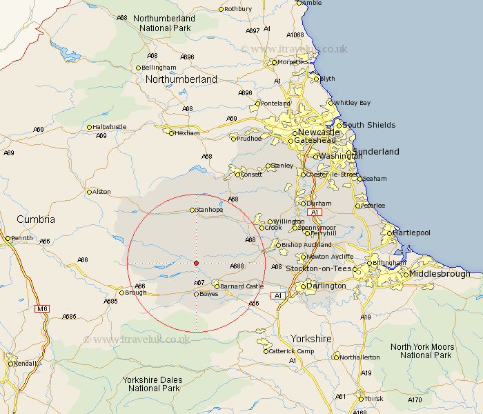
Durham Map Showing Location of Eggleston
Population: 410
District: Teesdale
Easting: 400000 Northing: 522771
Latitude: 54.6 Longitude: -2
 = Eggleston
District: Teesdale
Easting: 400000 Northing: 522771
Latitude: 54.6 Longitude: -2
= Eggleston
This Eggleston map below is supplied by Google. Use the tools in the top left corner to zoom into street level or zoom out for a road map, you may also need to zoom in to see Eggleston on the map. Click and drag the map to move around. If the map fails to load try and refresh your browser or zoom in or out (+ or -).
Update - it seems Google no longer allow people to use their maps for free! This Eggleston map sometimes loads and sometimes gives a error. I am working on a solution.
Closest 30 Towns or Cities to Eggleston (Population over 500)
Cotherstone 3.86km Middleton in Teesdale 5.68km Startforth 9.16km Barnard Castle 9.16km Cockfield 13.01km Staindrop 13.41km Wolsingham 14.99km Evenwood 15.14km Stanhope 16.71km Etherley 17.03km High Etherley 17.03km West Auckland 17.56km Gainford 18.06km Tow Law 18.94km Crook 20.44km Bishop Auckland 22.17km Shildon 22.84km Willington 23.25km Coundon 23.71km Cornsay 25.3km Castleside 27.32km Newton Aycliffe 27.97km Spennymoor 28km Esh 28.06km Darlington 28.9km Lanchester 29.56km Brandon 29.76km Consetti 29.79km Consett 29.79km Ushaw Moor 30.35km