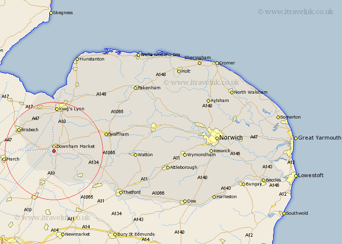
Norfolk Map Showing Location of Denver
Population: 847
District: King's Lynn and West Norfolk
Easting: 560325 Northing: 301061
Latitude: 52.58 Longitude: 0.37
 = Denver
District: King's Lynn and West Norfolk
Easting: 560325 Northing: 301061
Latitude: 52.58 Longitude: 0.37
= Denver
This Denver map below is supplied by Google. Use the tools in the top left corner to zoom into street level or zoom out for a road map, you may also need to zoom in to see Denver on the map. Click and drag the map to move around. If the map fails to load try and refresh your browser or zoom in or out (+ or -).
Update - it seems Google no longer allow people to use their maps for free! This Denver map sometimes loads and sometimes gives a error. I am working on a solution.
Closest 30 Towns or Cities to Denver (Population over 500)
Downham Market 1.85km Hilgay 4.34km Southery 7.49km Runcton Holme 7.75km Runcton 7.75km Wereham 7.88km Watlington 9.34km Outwell 9.74km Upwell 10.3km Stoke Ferry 10.3km Shouldham 10.82km Welney 10.82km Emneth 12.55km North Runcton 13.73km Tilney St. Lawrence 13.73km Tilney Saint Lawrence 13.73km Tilney 13.73km Tilney St Lawrence 13.73km Marham 14.43km Methwold 14.44km Walsoken 15.46km Feltwell 15.84km Northwold 16.2km Middleton 16.29km Narborough 18.37km King's Lynn 18.57km Kings Lynn 18.57km Lynn Regis 18.57km Lynn 18.57km Clenchwarton 18.57km