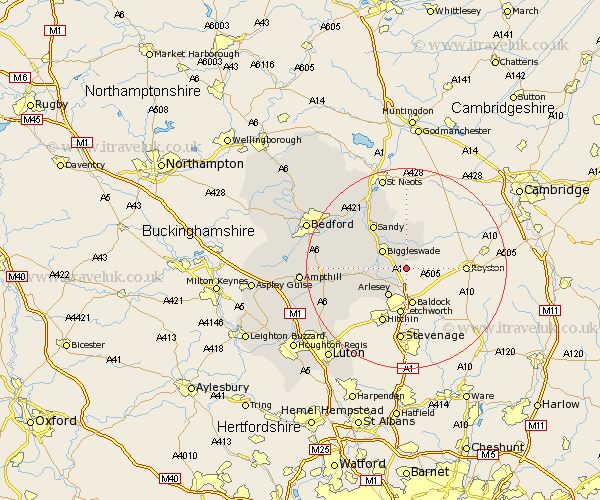
Bedfordshire Map Showing Location of Edworth
Population: 69
District: Mid Bedfordshire
Easting: 523416 Northing: 240643
Latitude: 52.05 Longitude: -0.2
 = Edworth
District: Mid Bedfordshire
Easting: 523416 Northing: 240643
Latitude: 52.05 Longitude: -0.2
= Edworth
This Edworth map below is supplied by Google. Use the tools in the top left corner to zoom into street level or zoom out for a road map, you may also need to zoom in to see Edworth on the map. Click and drag the map to move around. If the map fails to load try and refresh your browser or zoom in or out (+ or -).
Update - it seems Google no longer allow people to use their maps for free! This Edworth map sometimes loads and sometimes gives a error. I am working on a solution.
Closest 30 Towns or Cities to Edworth (Population over 500)
Langford 4.56km Stotfold 5.67km Biggleswade 5.87km Arlesey 6.53km Arlesley 6.53km Henlow 6.8km Southill 6.84km Clifton 7.09km Potton 7.42km Cockayne Hatley 8.17km Shefford 9.31km Everton 9.54km Northill 9.72km Stondon 9.73km Meppershall 10.68km Sandy 10.92km Campton and Chicksands 11.55km Blunham 12.22km Shillington 12.66km Gravenhurst 12.69km Tempsford 13.05km Cople 14.56km Roxton 14.66km Willington 14.68km Haynes 14.82km Great Barford 15.12km Clophill 15.28km Silsoe 15.83km Wilstead 16.06km Wilshamstead 16.06km