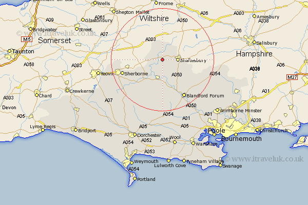
Dorset Map Showing Location of East Stour
Population: 548
District: North Dorset
Easting: 380120 Northing: 122388
Latitude: 51 Longitude: -2.28
 = East Stour
District: North Dorset
Easting: 380120 Northing: 122388
Latitude: 51 Longitude: -2.28
= East Stour
This East Stour map below is supplied by Google. Use the tools in the top left corner to zoom into street level or zoom out for a road map, you may also need to zoom in to see East Stour on the map. Click and drag the map to move around. If the map fails to load try and refresh your browser or zoom in or out (+ or -).
Update - it seems Google no longer allow people to use their maps for free! This East Stour map sometimes loads and sometimes gives a error. I am working on a solution.
Closest 30 Towns or Cities to East Stour (Population over 500)
Stour Provost 1.86km Gillingham 3.88km Marnhull 4.38km Motcombe 5.02km Shaftesbury 5.83km Stalbridge 8.06km Bourton 8.2km Fontmell Magna 8.94km Sturminster Newton 9.26km Child Okeford 9.9km Iwerne Minster 10.2km Charlton 10.66km Shillingstone 11.36km Stourpaine 14.23km Sherborne 16.16km Sherbourne 16.16km Pimperne 16.7km Blandford 16.93km Blandford Forum 16.93km Winterborne Stickland 18.86km Stickland Winterborne 18.86km Tarrant Monkton 20.4km Handley 20.6km Buckland Newton 21.91km Milton Abbas 22.24km Whitechurch 22.51km Yetminster 22.75km Bradford Abbas 22.96km Spetisbury 23.49km Leigh 23.85km