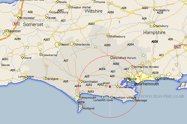
Dorset Map Showing Location of East Stoke
Population: 439
District: Purbeck
Easting: 387049 Northing: 87151
Latitude: 50.68 Longitude: -2.18
 = East Stoke
District: Purbeck
Easting: 387049 Northing: 87151
Latitude: 50.68 Longitude: -2.18
= East Stoke
This East Stoke map below is supplied by Google. Use the tools in the top left corner to zoom into street level or zoom out for a road map, you may also need to zoom in to see East Stoke on the map. Click and drag the map to move around. If the map fails to load try and refresh your browser or zoom in or out (+ or -).
Update - it seems Google no longer allow people to use their maps for free! This East Stoke map sometimes loads and sometimes gives a error. I am working on a solution.
Closest 30 Towns or Cities to East Stoke (Population over 500)
Wool 2.38km Wareham 4.7km Bovington Camp 5.05km Winfrith 6.94km Winfrith Newburgh 6.94km Bere Regis 7.78km Holton Heath Station 7.96km Holton Heath 7.96km West Lulworth 8.77km Lulworth Cove 8.77km Winterborne Kingston 9.35km Arne 10.73km Corfe Castle 10.92km Lytchett Matravers 11.07km Milborne Saint Andrew 11.64km Milborne St Andrew 11.64km Milborne 11.64km Milborne St. Andrew 11.64km Upton 13.4km Poole 13.44km Whitechurch 13.45km Sturminster Marshall 13.82km Puddletown 13.88km Piddletown 13.88km Worth Matravers 14.06km Worth 14.06km Osmington 14.07km Broadmayne 14.09km Milton Abbas 14.76km Langton Matravers 14.96km